The season’s most powerful thunderstorm so far lashed Kolkata on Thursday evening.
The Met office recorded around 40mm of rain in Alipore, the most the city received in seven months. The last time it was rainier was on September 12, 2022, when the city got around 50mm.
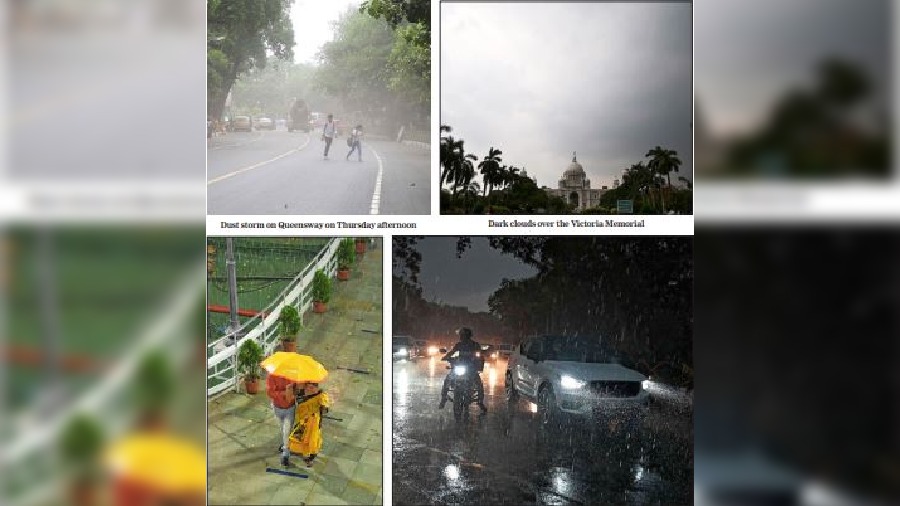
The rain was preceded by strong gusts of wind.
The maximum wind speed in Alipore was 79kmph, recorded around 4.45pm, said a Met official.
The spell came as a big relief as most of the day felt like a cauldron in Kolkata because of the twin assault of heat and humidity.
Around 12.30pm, the website of AccuWeather, a US forecasting agency, showed the temperature to be 35 degrees. The RealFeel was around 40, on account of the humidity, which was at a staggering 64 per cent.
But the situation started changing towards late afternoon. The first clouds appeared a little after 3.45pm. In less than an hour, the sky had changed colours.
Around 4.30pm, all vehicles on Red Road had their headlights switched on.
Moments ago, the Maidan saw waves of dust kicked up by the storm and visitors scurrying for cover. Even the cops on horses started racing towards a covered area.
In the Chowringhee area, the rain started around 4.40pm. The intensity picked up gradually. By 5.15pm, the showers were strong enough to blur the surroundings.

“The city was caught in the middle of two cyclonic circulations — one over Vidarbha (eastern Maharashtra) and the other over east Bangladesh — that resulted in heavy incursion of moisture,” a Met official said.
“The circulation over east Bangladesh and neighbouring areas extended up to 3.1km from the surface,” said the official.
The warm moisture-laden air from the sea came in contact with layers of cold air above and resulted in thunderclouds, which triggered the storm and the rain.
Most of the clouds that brought rain to Kolkata came from the direction of Jharkhand. The flow of the wind in the upper atmosphere was northwesterly.
Some districts like Birbhum got hailstorms.
The weather department attributed the formation of hail to the larger-than-usual volume of thunderclouds that, in places, touched the freezing troposphere. Parts of the city over which the cloud columns touched the troposphere got frozen raindrops.
On Monday, a spell of thundershowers, albeit much weaker, had brought temporary relief from the scorching conditions. But the next two days were back to being hot and sultry.
Because of the high moisture content, thunderstorms are not ruled out in Kolkata in the coming days, said the Met official.
“If a thunderstorm happens on Friday, the spread and intensity are likely to be lower than what happened today. But from Saturday, the intensity and spread are likely to go up,” said an official.