Rain in parts of Kolkata on October 23 evening signalled the approach of Cyclone Dana as shops shut down and people rushed home early. Latest reports indicate a marginal westward shift of the cyclone path, which could mean that slightly lesser impact on West Bengal.
Dana, the severe cyclone, is set to make landfall southwest of Dhamra port, near Bhitarkanika National Park in Odisha, close to midnight on October 24 and the entire process is likely to continue till the small hours of October 25, a senior scientist of the India Meteorological Department (IMD) said on Thursday afternoon.
Till reports last came in, the landfall point seemed to have shifted marginally towards the west, compared to the earlier prediction, as most of the seven models considered by the IMD have arrived at a consensus on the possible location and timing of landfall. Earlier, several models, three out of seven to be precise, indicated that the landfall may start early morning on Friday but the reasonable speed of the system, in the range of 10 to 15km per hour since early Thursday morning, is being attributed to the change.

“As the system seems to be shifting westwards, closer to Paradip and south of Bhitarkanika, West Bengal is expected to be slightly less affected by Dana compared to the earlier prediction. But we have to keep watch,” said K.J. Ramesh, former director-general of IMD.
Kolkata, located around 250km away from the possible landfall point and close to the edge of the cyclonic system, is likely to experience strong winds in the range of 60 to 70km per hour (kmph), gusting at 80kmph; as well as heavy to very heavy rain in few places. “We are prepared to counter the situation and appropriate directions have already been issued to related departments. We will have our control room ready throughout the night,” said mayor Firhad Hakim.
Sunderbans in South 24-Parganas is likely to face cyclonic winds in the speed range of 80 to 90kmph rising to 100km but the resultant storm surge may not be that high. The landfall is likely to partially overlap the high tide, as currently the maximum high-tide level is predicted to be normal compared to a situation called ‘mora jowar’ meaning weak high tide.
Cyclone moving at reasonable speed
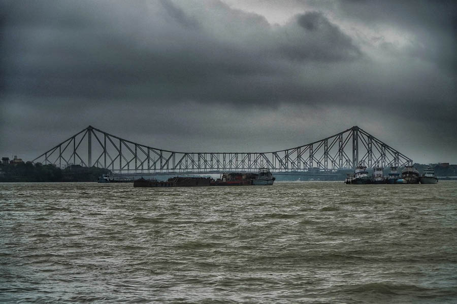
Dark, ominous clouds gather in the horizon beyond the iconic Howrah Bridge on Thursday evening Soumyajit Dey
The latest national bulletin, number 17, released at 4.30pm based on data received till 2.30pm on October 23, has pointed out that the landfall is likely to occur “close to Bhitarkanika and Dhamra” but the latitude–longitude analysis points towards a place called Tentulidadian, located marginally south-west of Dhamra port as the landfall point.
The bulletin states that “the severe cyclonic storm “DANA” ...over northwest Bay of Bengal moved north-northwestward at a speed of 10kmph during past six hours and lay centred at 1430 hrs IST of today, the 24th October, over the same region...about 150km southeast of Paradip (Odisha), 180km south-southeast of Dhamra (Odisha) and 250km south of Sagar Island (West Bengal)”.
“It is very likely to move north-northwestwards and cross north Odisha and West Bengal coasts between Puri and Sagar Island close to Bhitarkanika and Dhamra (Odisha) during mid-night of 24th to morning of 25th October, 2024 as a severe Cyclonic Storm with a wind speed of 100-110kmph gusting 120kmph,” added the report.
East Midnapore to be most affected in West Bengal
The IMD communiqué clarified that East Midnapore is likely to bear the brunt of the cyclone in West Bengal. “It (gale) would gradually increase becoming 100-110kmph gusting to 120 kmph along and off north Odisha and East Midnapore district of West Bengal from 24th afternoon till the morning of 25th October,” states the bulletin. The storm surge prediction is of 1 to 2 metre high astronomical tide in East Midnapore and Odisha districts, while the same is predicted at 0.5 to 1 metre for the Sunderbans.
“The peak of the next high tide is at about 3am in Sagar. Hence, the cyclone landfall may partially overlap with the high tide but as currently, the mora jowar is expected, we are not expecting much overtopping or breaching but we stand careful,” a senior state government official told this correspondent on Thursday afternoon.
The ‘mora jowar’ indicates a weak high tide and according to Kolkata Port Trust data, the maximum astronomical height expected on 25th October early morning is 3.8 metres above the astronomical height.
“As the combined height may be at most 5 metres, we do not expect overtopping in Sagar and adjoining areas. However, we have already fixed a few of the vulnerable embankment points. Nearly 23,000 people have been taken to disaster shelters and pregnant women have been shifted to hospitals as a precaution and people in the vulnerable Ghoramara Island have also been shifted to a new disaster shelter,” the block development officer of Sagar told this correspondent around Thursday noon.
“Though there are no strong winds yet, severe rain has started,” said Shankar Ari, a local from Bali Island in Gosaba within the Sunderbans.
More than 2.1 lakh people have been evacuated from vulnerable areas, including close to 23,000 from Sagar, and around 1200 relief camps have been opened up.