Kolkata is likely to experience heavy to very heavy rainfall in the range of 7cm to 20cm, accompanied by wind blowing at 60 to 70kmph between the night of October 24 and morning of October 25 — around the time Cyclone Dana is expected to hit the ground in Odisha. The Sunderbans in South 24-Parganas and the coastal belt of East Midnapore, which includes Digha, may bear some of the brunt of the landfall, according to weather experts.
The deep depression over the east-central Bay of Bengal that is set to turn into severe cyclonic storm Dana on Thursday is likely to make landfall close to Dhamra port in Odisha and then curve slightly leftwards within the state. West Bengal will be partially spared though the coastal districts, particularly East Midnapore and South 24-Parganas, on the right side of cyclonic movement are likely to be impacted, a senior India Meteorological Department (IMD) official said on October 23 morning.
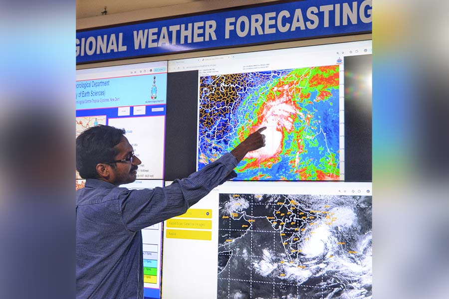
Scientist Sourish Bandopadhyay shows the progress of Cyclone Dana on a digital screen, at the Regional Weather Forecasting Centre in Alipore on Wednesday My Kolkata
Cyclones are often known to shift track and if the point of landfall gets any closer to West Bengal, then the state would be more affected. “West Bengal, particularly south Bengal, will be impacted,” Mritunjay Mahapatra, director-general of the India Meteorological Department, told this correspondent.
“Our present understanding is that the coastal districts in the state will be mostly affected though a major part of south Bengal is expected to receive strong winds and substantial rain,” said a senior disaster management department official of West Bengal.
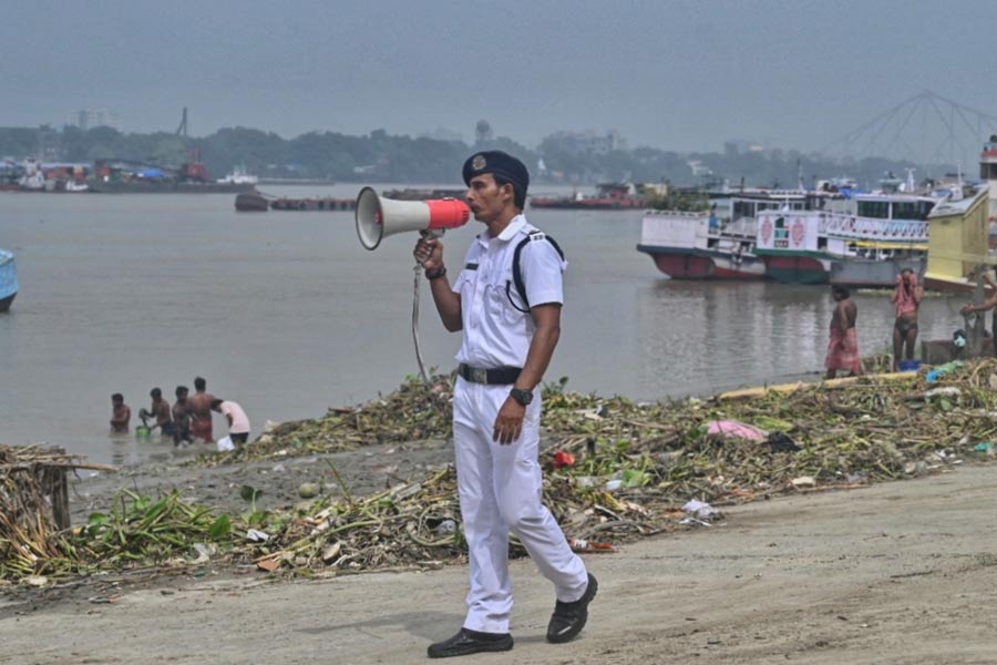
The West Bengal government has put seven districts in the state on high alert for the impending cyclone and formed a high-powered committee with several secretaries to oversee the situation. Chief minister Mamata Banerjee has announced that the government stands ready to tackle the situation and is taking care of the situation through a 24x7 control room.
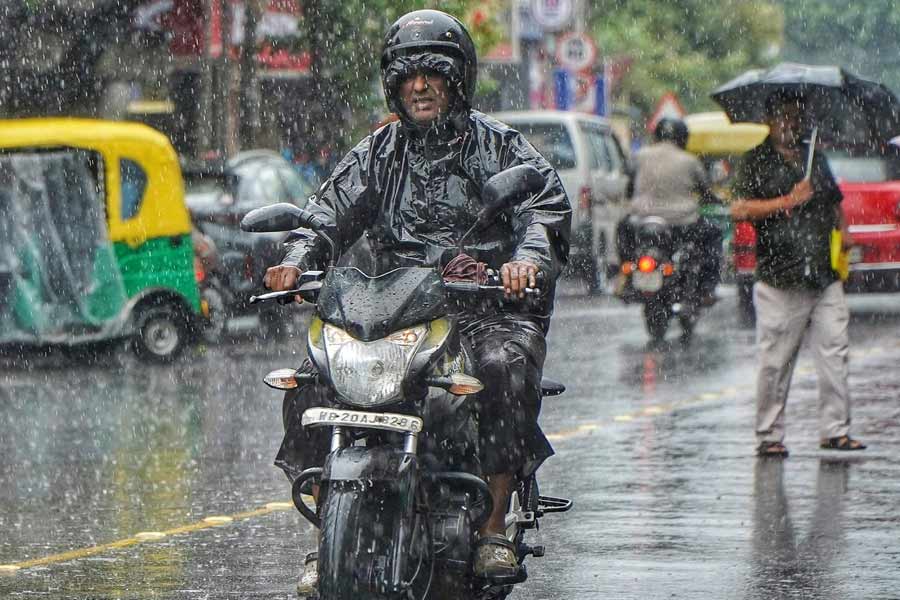
A biker caught in the Wednesday morning shower in Kolkata Soumyajit Dey
“East Midnapore could be affected along with North and South 24-Parganas, and Kolkata as well owing to heavy rainfall,” Banerjee said.
Kolkata, located around 250km away from the expected landfall zone, is expected to experience wind blowing at speeds of 60 to 70kmph, gusting up to 80km,
Severe cyclone to form on October 24 morning
“The cyclonic storm, Dana, over the east-central Bay of Bengal moved north-westwards at a speed of 15kmph during past six hours and lay centred at 0830 hrs IST Wednesday, October 23, over the same region … about 520km southeast of Paradip (Odisha), 600km south-southeast of Sagar Island (West Bengal) and 610km south-southeast of Khepupara (Bangladesh),” reads the latest IMD national bulletin issued at 11am on Wednesday.
“It is very likely to move north-westwards and intensify into a severe cyclonic storm over north-west Bay of Bengal by 24th early morning and cross north Odisha and West Bengal coasts between Puri and Sagar close to Bhitarkanika and Dhamra (Odisha) between October 24 night and October 25 morning as a severe cyclonic storm with wind speeds of 100-110kmph gusting at 120kmph,” adds the latest bulletin issued by scientist Ananda Kumar Das.
The track forecast says the possible landfall point could be near Dhamra, around 70km from Balasore as the crow flies. The forecast track shows the cyclone will be at 20.9 latitude and 86.8 longitude at 5.30am on October 25.
Cyclone may hit Sunderbans at 110kmph speed
“As the impact of the cyclone has generally been pronounced on the right side of the track, hence the West Bengal coastal districts remain vulnerable to the cyclonic system which is expected to have a radius of 300km,” said another senior IMD scientist.
The expert pointed out that while South 24-Parganas, especially the Sunderbans, may be affected for a short duration during the landfall, East Midnapore Medinipur and adjoining districts may be affected for a longer time. “The impact of a cyclone generally remains stronger on the right side of the path and, hence, coastal Bengal, particularly East Midnapore, is likely to be highly impacted,” the expert said.
“Light to moderate rainfall at most places with heavy rainfall in isolated places is very likely on October 23 and heavy to very heavy rainfall at a few places with extremely heavy rainfall at isolated places over South and North 24-Parganas, East and West Midnapore, Jhargram, Howrah, Hooghly, Kolkata and Bankura districts of Gangetic West Bengal on October 24 and 25,” reads the IMD’s local bulletin.
The bulletin further points out that “along and off Odisha-West Bengal coasts; squally wind speed reaching 40-50 gusting to 60 kmph is very likely to commence from October 23 evening” and then will gradually increase to “60-70kmph gusting to 80kmph from 24th morning and reaching 100-110kmph gusting to 120 kmph till October 25 morning and decrease gradually thereafter”.
The Alipore weather office has said that the gale speed may reach 100 to 110kmph gusting at 120 kmph, over East Midnapore; 80 to 90kmph gusting at 110kmph over Sagar and rest of the Sunderbans in South 24-Parganas; 70 to 80kmph gusting at 90 kmph over West Midnapore and parts of South 24-Parganas; and 60 to 70kmph gusting to 80kmph over Kolkata, North 24-Parganas, Howrah, Hooghly and Bankura districts.
The sea condition in the zone “is likely to be rough to very rough from October 23 evening and would become high to very high from October 24 morning to October 25 forenoon and improve gradually thereafter”. Fishermen have been asked not to venture out in the sea during the period.