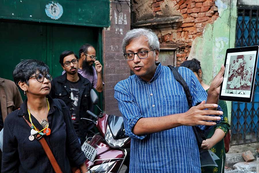
The evolution of a city is often visible in its maps. It is this evolution that DAG wanted to explore with ‘Mappa Theke Manchitra’, the latest segment of the fourth edition of their annual festival, The City as a Museum. Over the course of a leisurely stroll through a north Kolkata neighbourhood and the examination of the city’s oldest maps, My Kolkata drew some unique insights.
The session was conducted by Epsita Halder, an associate professor of Comparative Literature at Jadavpur University, and Sarbajit Mitra, an assistant professor of History at St. Xavier’s College.
Mapping the neighbourhood
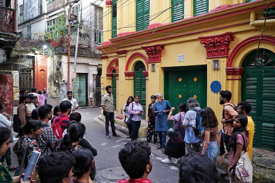
The event began with a walk around the neighbourhood, familiarising attendees with the evolution of Sovabazar. Pictured above is the residence of Gobor Goho, one of the first Indian wrestlers to find international success with his indigenous techniques
Held on November 17 at the office of P.M. Bagchi and Company, the evening commenced with a short walk around Sovabazar. By learning about the history of prominent landmarks like Brojokishore Thakurbari, Blackquire Square Park, Jora Shiv Temple and Ray Baari, attendees could understand the development of the area, with context to an old map of Sovabazar.
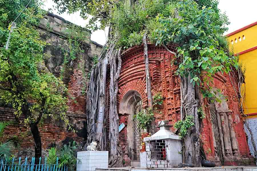
An 18th-century 'atchala' temple, Joramandir, has become a landmark in the locality for standing despite roots of a banyan tree penetrating into its foundation
Mitra added, “The Mughals didn’t have maps, but conducted detailed surveys to sustain the empire. Hence, texts like Abul Fazl’s Ain-i-Akbari were consulted by the British while drawing up India’s maps.”
A map of Kolkata from 1742 showing the Seven Batteries was regarded as one of the oldest depictions of the area. It depicted an extremely simplistic perception of the city, with a cluster of inhabited places near Fort William being marked with capital letters. Maps from 1756 proved to be a turning point, with cartography coming in. “Fort William is shown as the epicentre of the city in these maps. It also shows the perspective of the time, with the British largely seeing the city as the Dalhousie area,” Mitra said. James Rennell’s 1778 book, A Description of the Roads in Bengal and Bahar, substantiates this, with all the roads starting from Fort William.
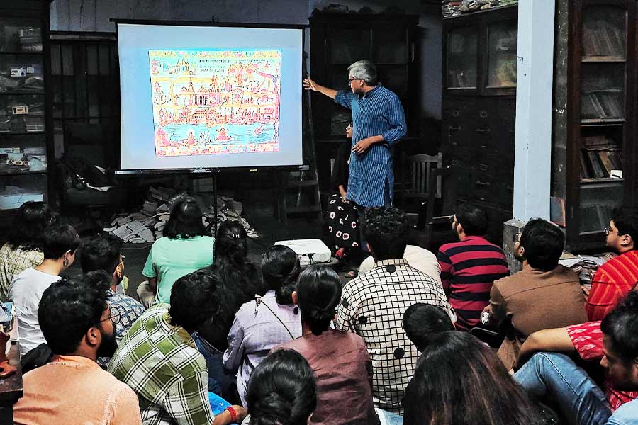
Mitra referred to the map of Kashi (Banaras) in Satyajit Ray’s ‘Joy Baba Felunath’ to reinforce how the map wasn’t specific to geography, but focussed on telling pilgrims about the places to see
Kolkata’s first maps
Lt. Col. Mark Wood’s 1785 map, though, was one of the first detailed documentations straying outside the White Town, bearing markings of the ghats and Maratha Ditch. Another milestone was the formation of the Lottery Committee of 1817, which helped the British government with town planning.
In the second half of the 19th century, many vernacular maps and street directors were published. Cartography and geography were also introduced as subjects in Hindu School (then Hindu College) at College Street, where the local ‘Babus’ were trained to become a part of the survey system.
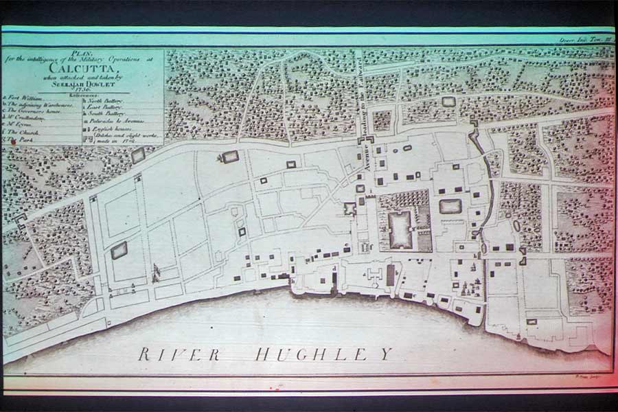
Seerajah Dowlet’s map of Kolkata from 1756 shows that only the ‘White Town’ was considered important, with the ‘Black Town’ being shrouded in greenery
Rajendralal Mitra, who was the first native president of The Asiatic Society, prepared The Bengal Atlas in the 1850s, not only creating a vernacular atlas, but also using the Bengali metric system, krosh. Mitra was also the one to analyse the nomenclature of the words map and manchitra — ‘map’ originates from the Latin word, 'mappa' meaning napkin, while manchitra stands for a measured image of land.
In 1915, P. M. Bagchi published a detailed street directory, which was revolutionary for incorporating vernacular cartographies at a scale hitherto unseen. The directory didn’t just have the names of the streets and their brief history, but also the names of all homeowners and businesses. This scale of work makes it an invaluable document to this day.
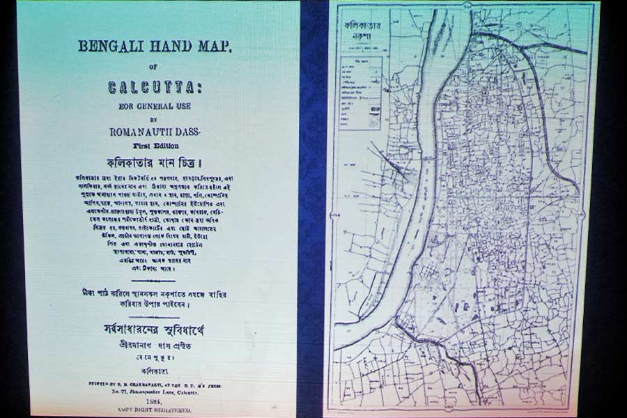
Ramanath Das’ ‘Kalikatar Manchitra’, one of the first map-cum-guidebooks in Bengali, which was published in 1884. It was intended to be used by the common people
“The P. M. Bagchi Directory at the core of this event was ground-breaking because it presented a bottom-up perspective of the city with new routes and sites of interest. We hope that The City as Museum festival helps people chart their own new pathways through Kolkata, and in turn encounter diverse perspectives,” said Sumona Chakravarty, vice-president of museums at DAG.
