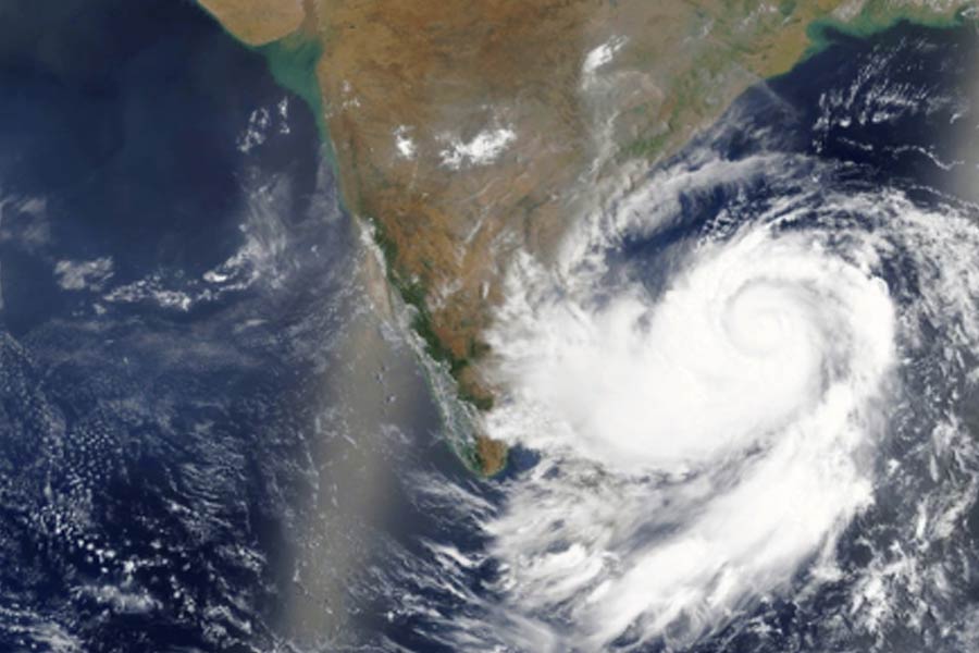
A well-marked low-pressure area over the east-central Bay of Bengal is likely to intensify into a depression by the morning of October 22 and develop into a cyclonic storm by October 23, the India Meteorological Department (IMD) said on Monday.
The system is expected to move northwestwards, making landfall between Odisha’s Puri and West Bengal’s Sagar Island between the night of October 24 and the early hours of October 25 as a severe cyclonic storm.
The IMD forecast wind speeds of 100-110 kmph, with gusts up to 120 kmph, during landfall. Heavy to very heavy rainfall is predicted over parts of Odisha and West Bengal. Coastal districts, including Puri, Khurda, and Jagatsinghpur in Odisha, will experience extremely heavy rainfall on October 24-25.
The weather agency has advised fishermen to return to the shore by Monday evening and avoid venturing into the sea until October 26. An orange warning has been issued for heavy to very heavy rainfall across Kendrapada, Cuttack, and Nayagarh districts. Several districts, including Bhadrak, Balasore, and Mayurbhanj, are under a yellow alert for isolated heavy rains.
Odisha government officials have put coastal districts on high alert and are preparing for evacuations from vulnerable areas. Gale-force winds are expected to intensify from the night of October 23, further escalating by October 24 night.
The IMD’s Director General, Mrutyunjay Mohapatra, warned that Odisha is likely to face the cyclone’s maximum impact, with the storm spending considerable time along the coast, resulting in heavy rainfall and high winds.