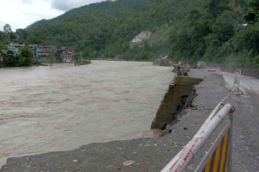
The heavy monsoonal downpour that triggered landslides in many parts of Sikkim also caused the Teesta to swell, which now is eroding mounds of earth from under NH10, the principal highway that connects Sikkim and Kalimpong with Siliguri and rest of the country.
Along NH10, cracks have developed beside the road on many stretches, prompting the police and the local administration to put guardrails and fluorescent tapes to keep vehicles away from the damaged portions.
“The Teesta is constantly eroding land in locations such as Melli, Teesta Bazaar and 28th Mile. Such erosion has led to cracks in the highway. If the water levels don’t recede and erosion continues, there is a risk of cave-ins. That is why, drivers have been advised to drive with caution,” said a source in the Kalimpong district administration.
Last October, when a flash flood occurred in the Teesta because of the glacial lake outburst flood in South Lhonak Lake in north Sikkim, the river had swept away many stretches of NH10.
“The stretches were eventually repaired and traffic resumed on the route. However, over the past couple of months, multiple landslides in Likhu Vir, Ravi Jhora and some other areas along the highway damaged the stretches again and disrupted connectivity,” the official added.
Now if there are cave-ins at the cracked parts, the stretches would get narrower and vehicles, especially heavy vehicles, would be forced to take detours, the official added.
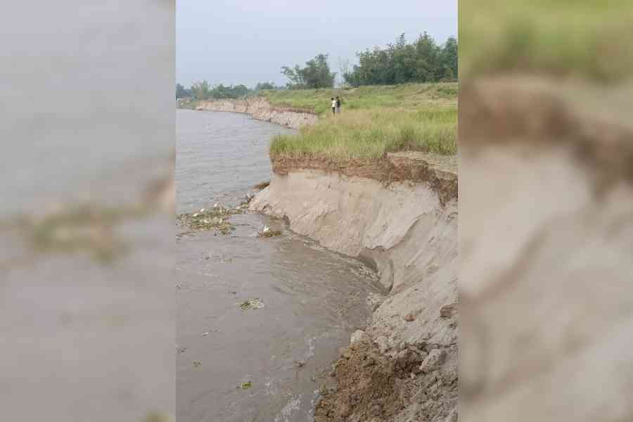
Residents of Kesharpur village in Manikchak block, Malda, stand at the confluence of the Fulhar and Koshi rivers that started eroding land on Friday
The alternative route to Kalimpong and Sikkim — the most popular being the Gorubathan–Lava route — means an additional travel of at least 70km.
Sources in the state PWD which maintains the road said they were clearing debris caused by landslides. “However, permanent repair work can be carried out only after the weather conditions improve,” said a source.
Such recurring disruptions on the highway have prompted Raju Bista, the Darjeeling MP, to approach the Centre with the request that the Bengal stretch of the highway be handed over to the National Highways and Infrastructure Development Corporation Limited (NHIDCL) or the National Highways Authority of India (NHAI).
Along with residents and tourists, the highway is regularly used by defence forces to move to Sikkim, a mountainous state on the India-China border.
Right now, traffic is still moving on NH10, but vehicles can't move on the road connecting Darjeeling with Kalimpong because the Teesta has inundated the Teesta Bazar stretch and flooded some houses.
“We are keeping a watch over the situation. People have been asked to be on alert and shift to safer places in case water levels rise,” an official said.
Malda erosion
In Malda district, two rain-fed rivers have started eroding land in parts of at least two blocks over the past two days.
Fulhar, sources said, has been eroding its banks in Harishchandrapur-II block since Thursday night. The erosion has left residents of Kowadol, Rashidpur, Uttar Bhakuria, Dakshin Bhakuria, Mirpara and Tantipara villages worried that the river would eventually gobble their land and homes.
“The river is flowing barely 100 metres away from my village,” said Alam Sheikh of Rashidpur.
Erosion has been reported at the confluence of the Fulhar and the Koshi. The rivers are flowing hardly 20 metres away from the embankment in Kesharpur village of Manikchak block.
“The rivers are eroding earth along a 200-metre-long stretch and water is steadily advancing towards the embankment. We are keeping our fingers crossed. If the embankment is breached, our village will be underwater,” said Birbal Mahato, a villager.
Pankaj Tramang, the subdivisional officer (Sadar) has visited the erosion-hit areas in Manikchak, said sources.
“Officials of the two blocks have been put on alert,” said a district administration official.
The 40th battalion of the BSF posted in Jalpaiguri district on Friday also evacuated residents of Singhpara village located on a dry bed of the Teesta river when residents reported that the swollen river had started gobbling land of their village.