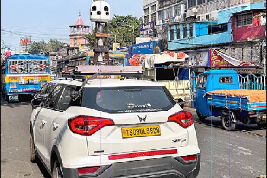
A stone’s throw from Golbari in Shyambazar, a Mahindra XUV 300 with a contraption on top was trying to make its way beyond the five-point crossing, headed towards the popular sweet shop Adi Haridas Modak, attracting surprised looks from passersby.
Chances are you will spot one of these cars in Calcutta over the next few weeks.
The Apple website mentions the company is “conducting ground surveys with vehicles around the world to collect data to improve Apple Maps” and “to support the Look Around feature”, a technology that provides interactive panoramas from positions along streets in various countries.
Apple has been giving Google Maps a run for its mileage with high-quality up-to-date maps. The cars may revisit and recollect data from some places to gather more details.
When Apple Maps was launched on September 19, 2012, the app ran into a series of issues, such as a park in Ireland being mislabeled as an airport and a road going over one of the Golden Gate Bridge’s suspension towers.
But by January 2020, a redesigned Apple Maps began to win back customers and much more functionality has been added since.
Earlier this year, Apple Maps on the web became available in public beta, allowing users around the world to access Maps directly from their browser.
The improvements in Apple Maps are coming at a time when Google Maps is under scrutiny.
In November, three men were on their way to Bareilly to attend a wedding and were using Google Maps but their car veered off a half-finished bridge in Uttar Pradesh’s Badaun and into the Ramganga river.
The incident resulted from a project abandoned midway, and a tale of negligence and official apathy.
To protect the privacy of people on the streets, Apple Maps is censoring faces and licence plates on images published in Look Around. If somebody wants a face, licence plate, or house to be censored, there is help on the company’s website.
Also, the company is conducting surveys with portable systems in select pedestrian areas, like streets in Mumbai where cars are not easily manoeuvrable.
A few pedestrian surveys use a backpack system to collect data that may be used directly in Apple Maps, such as in the Look Around feature, while other pedestrian surveys use iPads, iPhones and other devices to collect data for map improvement.
The survey using vehicles is on in Bengal — like in Delhi — till December 31, the website says.
Arunachal Pradesh, Assam, Bihar, Kerala, Manipur, Meghalaya, Mizoram, Nagaland, Sikkim and Tripura have their dates next year. Transit surveys with iPhone/iPad in states such as Bengal, Maharashtra and Gujarat will continue till March 31.


