A system from Pakistan moving towards the Northeast and another over the Bay of Bengal will work together to make the next two days cloudy and rainy in Calcutta and other parts of south Bengal, the Met office has said.
“Generally cloudy sky with light rain” is the Met forecast for Calcutta for Friday and Saturday.
The Met office warned of “dense fog” over East and West Burdwan, Birbhum, Murshidabad, North and South 24-Parganas, Hooghly, Nadia, Howrah and Calcutta on Saturday.
The Celsius has been on the rise in Calcutta. For the past couple of days, the minimum temperature has been above normal and hovering in the 16-17 degree range. The moisture incursion in the form of southeasterly winds from the Bay has stalled the flow of dry and cold northerly winds.
The overcast conditions, however, will have a bearing on the day temperature, which is likely to be on the lower side.
“Yesterday’s well-marked low-pressure area over south-west Bay of Bengal was over southwest adjoining west-central Bay of Bengal at 8.30am on Thursday. The system is likely to move nearly northwestwards towards north Tamil Nadu and south Andhra Pradesh coast during the next 12 hours. Thereafter, it is likely to move nearly northwards along Andhra Pradesh coast in subsequent 24 hours,” a Met report said.
“A Western disturbance seen as a trough in lower and middle tropospheric westerlies runs roughly... with an induced cyclonic circulation in the lower levels over northwest Rajasthan and neighbourhood,” the report said.
The Western disturbance will move from west to east. “The interaction between the trough and the easterly and southeasterly winds from the low-pressure area will lead to the formation of clouds,” said a Met official.
A Western Disturbance is an extra-tropical storm that originates in the Mediterranean region and often causes winter rain and snowfall in India.
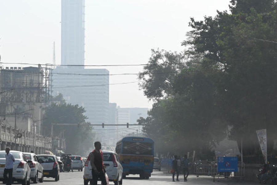
The city sky was hazy in parts on Thursday. The 42 in Chowringhee was shrouded in a blanket of fog, as was the Vidyasagar Setu, in the afternoon.
The city has witnessed one proper spell of chill so far this season. The minimum temperature was in the 12 to 14-degree range between December 12 and 16, before starting to rise again. In the districts, the minimum temperature went under 10 degrees Celsius. In Calcutta, December 15, has been the coldest day of the season so far, with a minimum of 12.5 degrees.
“The mercury will start dipping after the two systems are gone,” said the Met official.
But the Met forecast warned of another Western Disturbance. “A fresh and active Western Disturbance is likely to affect the Western Himalayan region and adjoining plains from December 27,” said a bulletin.
Last winter, successive Western Disturbances led to the formation of weather systems over northern parts of India that robbed Calcutta of the chill for a long time.


