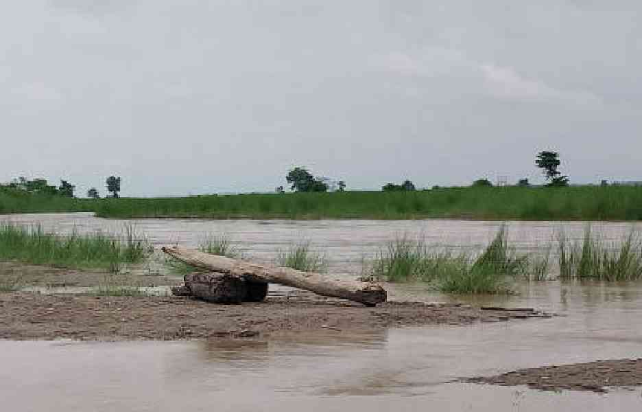
The Bengal irrigation department has engaged the River Research Institute (RRI) to study the impact caused by four tributaries of the Teesta which swells up during the monsoon inundating low-lying areas and eroding chunks of land.
“We have found that during monsoon months, these four rivers swell up and discharge huge volumes of water into the Teesta. As a result, the Teesta floods vast stretches of land downstream and erodes chunks of land. To prevent the floods and the erosion, the RRI has been assigned the task of conducting a survey on the four rivers and recommending steps to handle the situation,” said Krishnendu Bhowmik, the chief engineer (northeast) of the irrigation department.
“The situation is aggravated by the release of water from the Teesta barrage in Gajoldoba,” said an official.
The RRI is headquartered in the Nadia district.
The four rivers that merge with the Teesta are Nandikhola, Zurantikhola, Leesh and Ghish, which all flow through Jalpaiguri district.
Bhowmik said if an unusual amount of water was released from the barrage, particularly during the rainy season, the department issued an alert for the districts concerned. “The alert is specially meant for people living in unprotected and low-lying areas,” he said.
However, although less quantity of water was released from the barrage in June and July, the Teesta rose and flooded its banks downstream in blocks like Rajganj, Kranti, Malbazar and Sadar in Jalpaiguri district and Mekhliganj in Cooch Behar district.
The Supervisory Control & Data Acquisition System (SCADA) is used to measure the water level of the Teesta at Gajoldoba.
“We realised that discharge of huge volumes of water by the four rivers, which also swell during the monsoon, had increased the water level of the Teesta,” he added.
Bangladesh, which is a lower riparian country, wants a specific quantity of water from the Teesta which flows into the country via Mekhliganj of Cooch Behar.
Bengal chief minister Mamata Banerjee maintains that the Teesta has adequate water only during the monsoon.
“We have good relations with Bangladesh but we cannot provide water from the Teesta round the year. It is only during the monsoon that the river swells. If water is provided to Bangladesh, residents of north Bengal will face a drinking water crisis,” she had said.
The situation downstream the Gajoldoba barrage substantiates Mamata’s claim, said a senior official of the irrigation department.
“We face floods only during the monsoon and not during other seasons. This shows that the chief minister is correct in her assessment that the Teesta doesn’t have adequate water round the year,” he said.
The RRI, sources said, will find out the quantity of water that flows into the Teesta from the four tributaries. Experts who conduct hydrological observations will also be included in the team.
They will also assess the quantities of minor minerals (boulders and sand), silt and timber which flow into the Teesta.
“These items increase the level of the river bed and the impact has to be measured. Teesta’s bed has already increased after last year’s flash flood. It will also be checked whether the four rivers are carrying such items to the Teesta. The information will help us draw up plans to prevent floods and to conserve the river,” said an engineer of the irrigation department.
The survey, he said, will be carried out during the ongoing monsoon when the inflow of water into the Teesta from other rivers is highest.
“Let the RRI come up with its recommendations. We will then consult with the state government and draw up plans to mitigate floods and erosion,” said Bhowmik.