The inter-departmental team constituted by the Sikkim government has started a comprehensive study of glacial lakes in the Himalayan state and is simultaneously conducting programmes in remote hilly hamlets to apprise the residents of precautionary measures which can mitigate damage during a glacial lake outburst flood (GLOF).
On October 3 last year, a GLOF, which occurred on the South Lhonak Lake in Mangan district, devastated different areas of the state, claiming the lives of over 100 people and damaging properties and infrastructure.
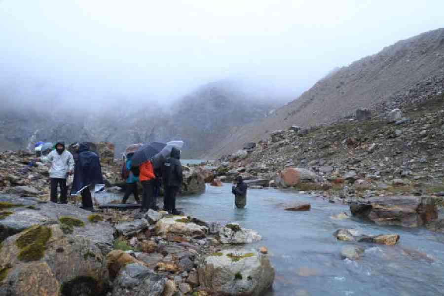
The natural disaster prompted the state government to take the initiative to study the vulnerability of glacial lakes. On August 31, an expedition was flagged off from Gangtok to conduct the study in six high-risk glacial lakes, Tenchungkha, Khangchung Chho,
Lachen Khangtse, Lachung Khangtse, La Tsho and Shako Chho. All the lakes are in Mangan district.
“On September 1, the team reached Tenchungkha Lake which is located at a a height of 15,700 feet, in Lachung. During the visit, traditional prayer ceremonies were performed by a body of local monks as the lake is considered sacred. Then, the team commenced its study,” said a source.
At the lake, the team conducted the Ground Penetrating Radar (GPR) and electrical resistivity tomography survey (ERT) tests to evaluate the stability and potential risk factors of the moraine dam of the lake. Also, morphometry studies and lake discharge
measurements are carried out.
“Such studies and tests are necessary to draw up plans for mitigation of damage during a GLOF,” the source added.
In the course of the expedition, the team will also conduct three-dimensional terrain mapping of the lakes by using drones. Also, the flow dynamics of the lake’s outlet will be studied to understand the hydrology of each of the six lakes.
The team comprises representatives from the state departments of land revenue and disaster management, science and technology, mines and geology, water resources, forest and environment along with people from certain central agencies and the Sikkim University.
As a part of the expedition, the team members also conducted a participatory rural appraisal exercise at Lachung.
During the exercise, they apprised school students and locals that Tenchungkha has been identified by the National Disaster Management Authority as one of the 16 vulnerable lakes in Sikkim.
“The exercise was held to prepare evacuation maps for vulnerable hamlets of Lachung. The residents were briefed as to how they could save themselves in case there was a breach in the lake and water started descending. Such sessions would be conducted in other locations during which locals will identify probable evacuation routes and safe places which they can use in case of a GLOF,” said an official.
On Thursday, the team reached Lachen to continue their study. The expedition will end on September 14 after which a comprehensive report will be submitted to the state government.