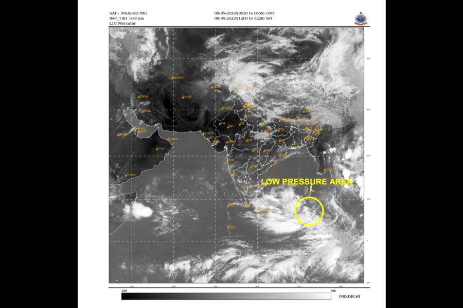
Based on its current observation of the low pressure area which has formed over the Bay of Bengal on Monday morning, the Indian Meteorological Department (IMD) has predicted that Cyclone Mocha is likely to make a landfall on the Bangladesh-Myanmar coasts sometime between the midnight of May 13 and the following midday of May 14.
Despite that, yet another spell of heat wave would grip parts of Gangetic Bengal from May 9-11 with the possibility of the mercury soaring to a record high in Calcutta on Wednesday, May 10, the weather office warned.
“A low pressure area has formed over South-East Bay of Bengal and adjoining South Andaman Sea at 0830 today. It is likely to intensify into a depression on 9th May over the same region and further into a cyclonic storm over South-East Bay of Bengal and adjoining areas of East Central Bay of Bengal and Andaman Sea on 10th May. It is likely to move initially north-northwestwards till 11th May. Thereafter, it is likely to recurve gradually and move north-northeastwards towards Bangladesh-Myanmar coasts,” an IMD bulletin published on Monday afternoon read.
Briefing reporters at the Bengal secretariat, Nabanna, after a preparatory meeting on counter measures for the possible storm, chief minister Mamata Banerjee said: “We are keeping our evacuation, relief and rescue mechanisms ready for the eventuality of the storm hitting the state. Right now, there is no cause for panic. But we have opened integrated control rooms here at the Nabanna as well as at the coastal areas of Digha and the Sunderbans. These control rooms are already functional and are being manned round-the-clock. We are prepared for any eventualities.”
The state has already issued a ban order on fishing in the sea till May 14.
Despite outlining a possible route that Cyclone Mocha would take once the formation takes shape on Wednesday, the IMD is yet to provide any details on the possible speed and intensity of the storm. Mocha has, so far, been termed as a "very severe cyclonic storm" which means a sustained wind speed of 110-150 kmph gusting up to 170 kmph once it hits the shores. That kind of wind velocity, if sustained over a considerable period of time over land, can wreak large scale destruction of life and property.
Meanwhile, the department has asked the people of south Bengal to brace for yet another spell of heat wave this week. Coupled with the high humidity the region would experience, the high discomfiture levels are likely to persist till Thursday, an official said.


