It’s not a trek — not at all a mere “trek”. It’s an adventure steeped in nature, legend and above all — a test of endurance!
Rudranath, one of the Panch Kedars in the Garhwal region of Uttarakhand, is dedicated to Lord Shiva. It is (perhaps) the only shrine where the face of the deity is worshipped. The temple, located at an altitude of 11,800ft, would draw those seeking beauty, solitude and a touch of the divine. Unlike the well-known Kedarnath, Madhyamaheshwar or Tungnath trails, the Rudranath trek boasts its own challenges as well as rewards. The arduous trek involved may well explain why this temple attracts smaller crowds in comparison to its counterparts among the four Kedars.
Sagar Village to Chandrakoti (0km to 1.5km)
The traditional starting point of the trek begins from Sagar village, which is about 10km from Gopeshwar, the nearest town. As you start, you’ll find that the first section of the trek is relatively moderate, allowing one to acclimatize to the pace of walking. This stretch is flanked by the upper portion of Sagar village — clusters of simple dwellings, slopes of farmlands, stables, small temples and the local folk — places from where you can collect last-minute supplies such as snacks and other essentials.
The trail starts in a gentle way, meandering through village fields and small forests. At about 1.5km, you’ll reach Chandrakoti, a cluster of a few inns that serve you tea and breakfast — go for paratha or Maggi. Eat light so that you can walk comfortably.
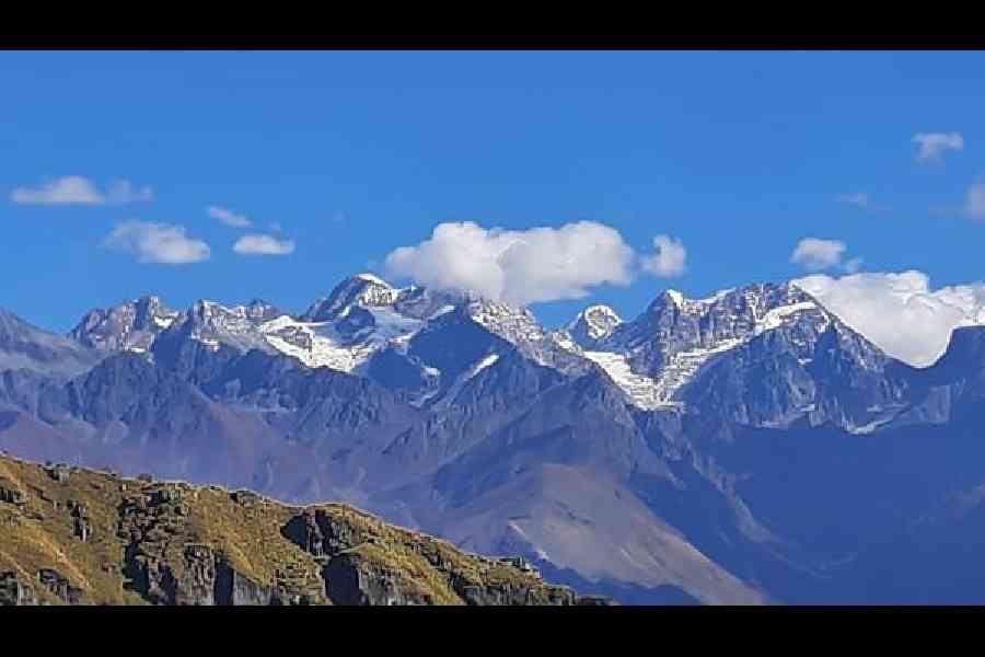
Peaks as seen from Panar Bugyal
Spend some time here as at this first pit stop, it’s quite something to sit under the October sky, sipping tea and discussing “matters of national interest” with the local folk while being surrounded by sun-kissed mountains.
Chandrakoti to Pung Bugyal (1.5km to 3.5km)
From Chandrakoti, the trail begins to show its rough character. As you trek towards Pung Bugyal, the terrain starts getting steeper and steeper. Here, the trail is made of huge boulders, some of them up to two feet high, making the journey more of a continuous climb rather than a moderate trek. It’s a slow but steady ascent.
But it’s perilous as quite often the trekkers will find themselves using their hands to steady the climb over the boulders. A walking stick is a must in Rudranath trek. Nevertheless, amidst the challenge, the natural beauty becomes more vivid.
On the way to Pung Bugyal (meadow) comes the forest checkpost. Officials deployed here would check the number of plastic in your baggage, with a reminder that you must bring back every piece you carry. As part of the environmental conservation efforts within the famous Kedarnath Wildlife Sanctuary, the forest department also charges a fee of ₹200 per person for trekking this path.
Move on and you will find that the dense forest around Pung Bugyal is a treasure trove of Himalayan flora. Trees of rhododendron, oak and pine here create a canopy that shields you from the sun, while tiny wildflowers are scattered on the forest floor. Feel the air — cool and fresh, you will get the scent of pine needles — a trait of the mountains’ wild energy.
Pung Bugyal to Ghimghima Pani (3.5km to 5km)
After Pung Bugyal, the trail takes you to Ghimghima Pani, a small stream (almost invisible) that serves as a crucial stop for trekkers. The inns here are extremely basic, just a room made of stone with a few mattresses placed on the floor. The food available is simple too — typically rice, dal, rotis and pickles. Breakfast (if you haven’t had it at Chandrakoti) might include paratha, pickles and the ever-popular Maggi. The local people make Buransh juice from rhododendron flowers. Have a glass of this. It’s refreshing and can energise you. This juice, quite popular along the high-altitude trekking route stopovers, can be found at several stops along the way.
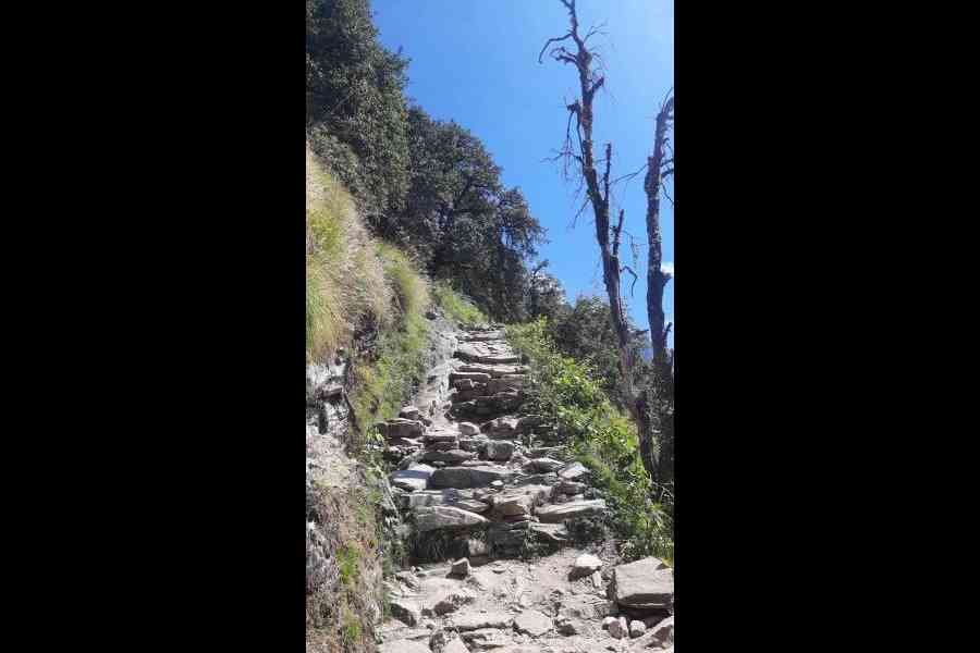
Steep trail filled with boulders ensuring almost a persistent climbing
The dense forest stretches on, but its nature differs from that of the last stretch of the Madhyamaheshwar trek. In any way, the Rudranath trail is pretty different from those of the other Kedars, where the paths can be well-trodden. But here, you need to persistently climb over rocks and boulders as the forest canopy gets thicker. It may create a sense of isolation, or maybe an immersion in nature.
Ghimghima Pani to Mauli Kharak (5km to 9km)
As you move past Ghimghima Pani and head toward Mauli Kharak, the terrain gets even more challenging. On one hand, the steep ascents continue, on the other, the trail grows narrower. The trees seem to close in around you, and the trek path is frequently punctuated by small streams and rocky stretches. Imagine that the forest itself is watching over you.
At Mauli Kharak, get a moment of rest. The inns here, again basic, offer some solace in the form of food, tea and shared accommodation.
The conversations with the inn owners here often revolve around the mountains and the pilgrims who pass by. Nevertheless, they’re as keen to know about the world beyond — and if you are from Bengal, they might ask you about the RG Kar controversy.
Mauli Kharak to Lwiti Bugyal (9km to 10km)
From Mauli Kharak to Lwiti Bugyal, the landscape gradually begins to shift. As you move on, the dense forest starts to thin out. Get your first real glimpses of the expansive bugyals, for which this trek is known. Remember, Lwiti Bugyal is the last point where you’ll find any sort of accommodation or food. The inns here are similar to those along the way before — stone rooms with a few mattresses, but blankets are aplenty. There are tents which you can also hire. The meals remain simple, as they have been all the way.
It’s advisable to consider Lwiti Bugyal as a night stopover on your way to Rudranath. This mountain slope is dotted with clusters of accommodation. Surprisingly, you will find some makeshift toilets and dustbins here as all the way back those are missing.
Lwiti Bugyal to Panar Bugyal (10km to 12km)
Once you pass by Lwiti Bugyal, the trek starts offering a barren landscape. Lwiti Bugyal, a transition point in the journey, apparently marks the last tree line on this route. The stretch from Lwiti Bugyal to Panar Bugyal can be considered the most desolate of the entire trail. There are now no inns, no villages, but only the open mountains and your thoughts. The landscape here is harsh with little vegetation and a sense of raw, untouched wilderness.
The wind here is stronger. Now, the altitude begins to take its toll. Once you reach Panar Bugyal it’s simply breathtaking. It offers an expansive view of the towering Himalayan peaks such as Nanda Devi, Trishul, Nanda Ghunti, Trishuli, Haati Parvat, Chowkhamba and so on. There is another forest checkpost at this meadow. The porters say that at an altitude of around 12,000ft, this lush alpine meadow is dotted with wildflowers during the summer months. This huge grassland offers a respite for trekkers after the rocky and forested stretches. Spend a moment here amidst Panar’s serene beauty and panoramic vistas. It’s a memorable stopover before making the final push towards Rudranath.
Beyond a certain point, the Rudranath trek offers a dichotomy — the vast valley, from where you start your trek, stretches out to the left, while the awe-inspiring snow-clad Himalayas rise to your right.
Panar Bugyal to Pitradhar (12km to 16km)
Pitradhar, the highest point on the route at 13,100ft, is the tip of a mountain. It gives one a breathtaking view of the surrounding peaks looming in the distance. Their snow-capped summits simply dazzle in the sun. Perhaps it’s the view that makes the climb worthwhile.
According to legends, Pitradhar is steeped in mythology. The name is derived from the word ‘pitras’, meaning ancestors or forefathers in the Hindu tradition, while ‘dhar’ stands for a ridge. This particular ridge is believed to be a spiritual gateway where the souls of the departed ancestors reside and bless the pilgrims who pass by. Trekkers here place small stone slabs one above another in memory of their forefathers. It is also believed that when one reaches Pitradhar, they are symbolically crossing into a realm close to their forefathers, making it a place of reverence and spiritual significance.
Pitradhar to Rudranath (16km to 22km)
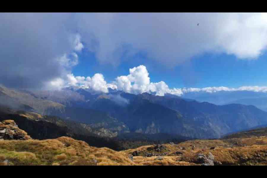
On way to Pitradhar
From Pitradhar, the trail begins to descend slightly, and the landscape gets easier to tackle. No more ascending or climbing rocks or making your way through the forest. Now, the meadows return, with wildflowers and small shrubs along the way. The last 6km to Rudranath is a gentle, almost dreamlike walk through alpine meadows offering the vistas of giant peaks. The greenery, soft grasses and the slopes are a balm to the senses, and of course, to your legs.
Finally, as you approach Rudranath, the temple comes into view, hanging on a mountain slope against the backdrop of the towering peaks. According to legend, post-Kurukshetra war, the Pandavas, in their quest for Lord Shiva, encountered him in the form of a bull. It is said that Bhim, the strongest among the five brothers, chased the bull, but it disappeared into the earth, with its face emerging here at Rudranath. That’s why the face of the deity is worshipped at Rudranath temple.
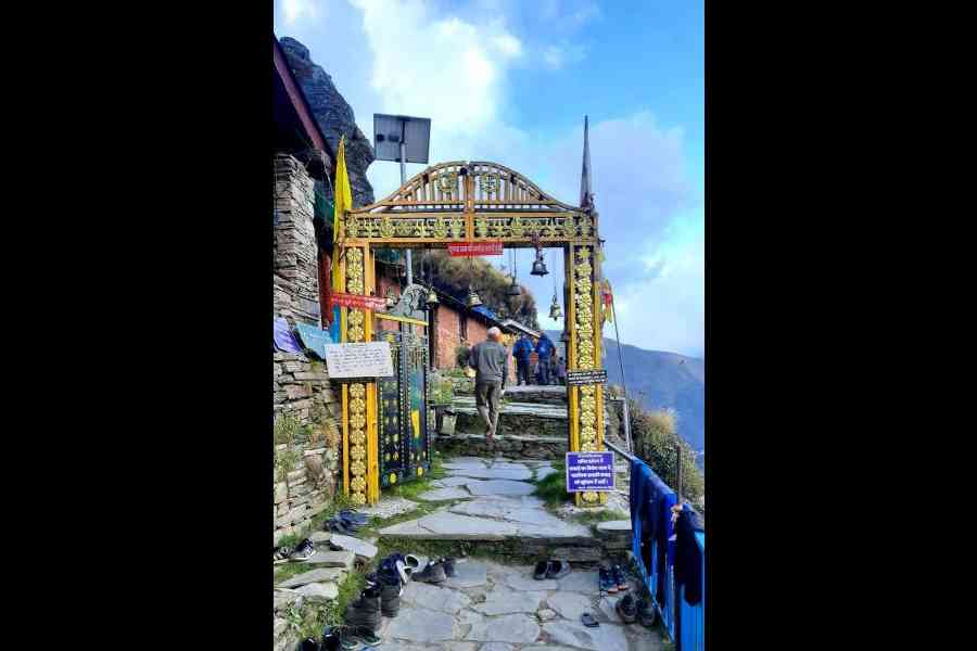
You will get quite a few dharamshalas queuing up to the temple. Before that, some private inn owners and tent providers are at your service. Same provisions here — basic food and lodging with almost unreal and panoramic views.
Behind the temple, trek up to a few hundred metres to find the Saraswati Kund, a small lake. It sits there like a jewel reflecting the peaks of Nanda Devi, Trishul and Nanda Ghunti. The serenity of the place, coupled with mythology and natural beauty, creates an aura of spirituality.
The Rudranath trek is bound to be a unique experience for trekkers any day. It’s a journey through dark forests, on boulder-filled and rocky paths, across barren landscapes and through vast alpine meadows. The simple huts, the humble food and the chat with local inn owners add to the journey’s charm.
It’s a pilgrimage not only to a temple, but also to nature, solitude and endurance.
Note: The distances between stopovers, as mentioned by local inn owners and porters, are based on their estimates. These figures may vary and might not be as accurate as those from official or geological sources.

