The science and technology department of Sikkim has launched a study to find out if glacier-fed lakes in the Himalayan state will trigger flash floods.
On October 4 last year, a glacial lake outburst flood (GLOF) from the South Lhonak Lake in the Mangan district of Sikkim had devastated several parts of the state and Kalimpong district of Bengal.
The department launched a two-week long expedition on June 22 to conduct the assessment of the East Rathong Glacier as well as three lakes — Rathong Lake, Bhaley Pokhari and Tikip La Lake — all located in western parts of Sikkim.
“In Sikkim, 19 potentially vulnerable glacial lakes have been identified so far. These three lakes are among the 19. After last year’s flash flood, there is an urgent need to conduct a comprehensive study of glaciers and glacial lakes. The findings will help in drawing up policies and strategies for climate adaptation and mitigation of risks during such disasters,” said a source in the department.
For the expedition, a team of scientists and researchers from the department reached Yuksom, the last motorable village in Gyalshing, a district in the west of Sikkim. From there, they trekked for three days to reach the East Rathong glacier, which has a width of around 800 meters and is located at an elevation between 4,600 meters to 6,700 meters in the Khangchendzonga National Park.
The glacier is also one of the sources of the Rangit river, which flows downstream into Bengal and meets the Teesta at Triveni, a location that is off NH10.
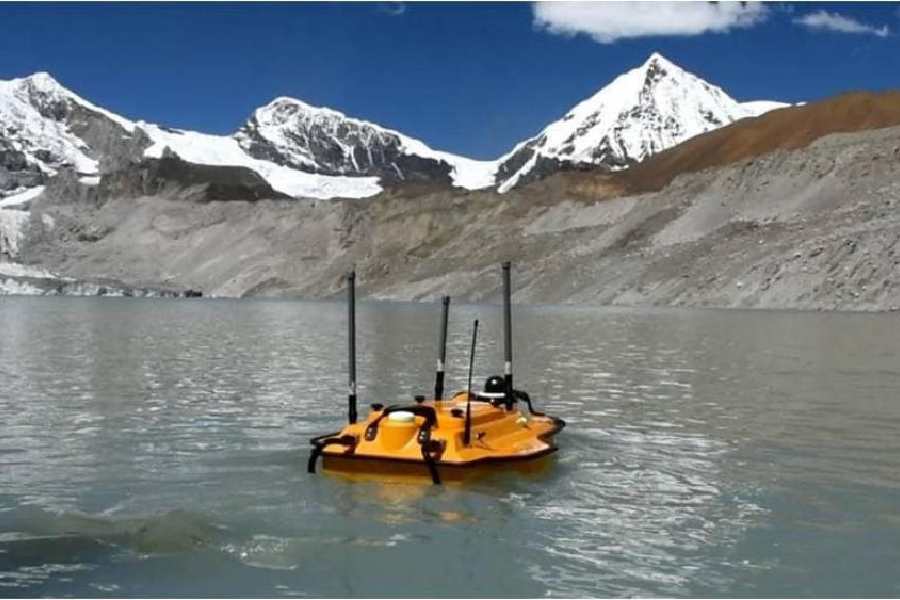
“The team is equipped with state-of-the-art instruments and technologies to ensure precise and accurate data collection. In all the three lakes, a bathymetric survey would be conducted to gather additional information,” the source added.
A bathymetric study is a hydrographic or water-based survey to map the depths and shapes of the underwater terrain in any water body.