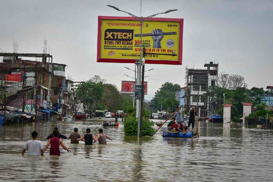
Six rivers in Assam and Manipur, including Brahmaputra, and Barak, are experiencing severe flooding, putting numerous districts in the region at risk, the Central Water Commission has said. The Brahmaputra river at Neamatighat in Assam's Jorhat district is flowing at 85.25 metres, which is 0.29 metres above its danger level of 85.54 metres, while the Barak river is in a severe situation.
In the Imphal East district of Manipur, the Barak River at Chotabekra is at 30.15 metres, 3.95 metres above its danger level. This significant rise poses a severe threat to the surrounding communities, according to the CWC data.
In Assam, the Barak River continues to impact various districts. At Badarpur Ghat in Karimganj district, the river is at 18.13 metres, 1.28 metres above the danger level while at Annapurna Ghat in Cachar district, it is at 21.52 metres, 1.69 metres above the danger level.
At Fulertal in Cachar district, the water level is at 25.94 metres, 2.06 metres above the danger level, showing a steady trend. At Dholai in Cachar district, it is at 24.9 metres, 0.32 metres above the danger level, with a falling trend.
The Kopili River at Kampur in Nagaon district is also in a severe situation, flowing at 62.08 metres, the Commission said, adding this level is 1.58 metres above the danger mark of 60.5 metres.
Although the trend is steady, the high water level remains a concern for the local population.
In Karimganj district, the Kushiyara river is at 16.5 metres, which is 1.56 metres above its danger level. The river's steady trend indicates that immediate action is required to mitigate potential flood damage, the Commission said.
The Katakhal river at Matijuri is flowing at 22.23 metres, 1.96 metres above its danger level, while the Dhaleswari river at Gharmura is at 28.18 metres, 0.13 metres above its danger level. Though the water levels are currently falling, both rivers remain in a severe situation, necessitating vigilance, the Commission said.
Over two lakh people have been affected by the flood situation in nine districts of Assam following incessant rainfall in the aftermath of cyclone Remal, officials said.
Altogether, six people have died in the flood, rain and storms in the state since May 28, they said.
Except for the headline, this story has not been edited by The Telegraph Online staff and has been published from a syndicated feed.