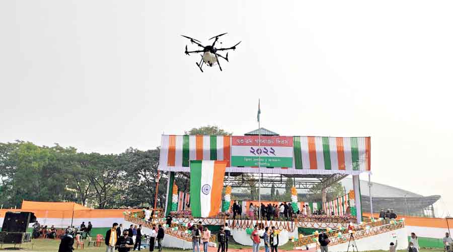
Drones developed by a start-up at the Indian Institute of Technology Guwahati that has been part of anti-disaster and anti-disease drives in Bengal were showcased at the Republic Day celebration in Assam’s Kamrup district, the first time UAVs were exhibited in the Northeast.
The show by the start-up, Drones Tech Lab (DTL), was held at the Kumar Bhaskar Barman Kshetra grounds near the Kamrup deputy commissioner’s office at Amingaon in North Guwahati to promote drone technology for the benefit of the region in the fields of disaster management, agriculture, survey and mapping, IIT Guwahati said.
During the 20-minute show, the drones were used to unfurl the Tricolour and record the event, officials said.
DTL’s drones were used in Bengal in the aftermath of Cyclone Amphan in 2020 to help rescue workers. They were also used to check erosion in Assam’s Majuli riverine island and during the ongoing anti-dengue drive in Calcutta, the IIT said.
During Amphan, the drones were deployed to “help” rescuers with real-time information on the ground situation, assess damage to infrastructure so that rescue routes could be planned, and locate stranded people and those trapped under debris.
The Calcutta Municipal Corporation’s anti-dengue drive using DTL that started in 2018 has reduced mortality by 30 per cent.
“A combination of mapping drone and heavy payload drone capable of spraying 10-16 litres of liquid over 6-7 acres of area uniformly within 9-10 minutes were used to contain dengue under the Calcutta municipal area,” the IIT said in a statement.
The Majuli anti-erosion drive in 2019 involved land survey using high-definition cameras affixed to drones. Drone use has not only reduced the time of identifying and planning the river revetment (sloped structures for protection against erosion) area but has also enhanced effectiveness by 80 per cent, an IIT source said.
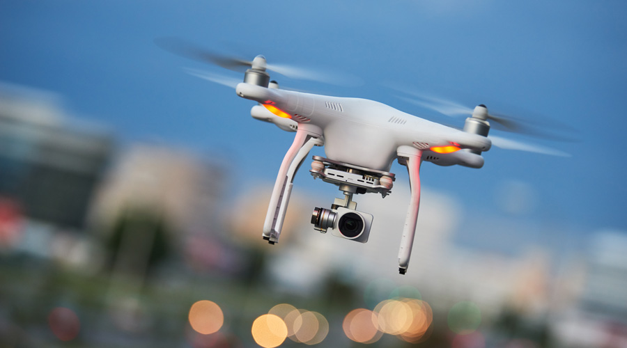
Two types of drones — heavy payload and day and night surveillance UAVs equipped with thermal cameras — were on display at the R-Day programme in Kamrup.
IIT Guwahati director T.G. Sitharam said that since the inauguration of the drone centre at IIT Guwahati, there had been several projects where the UAVs had been sought for faster data collection on land survey, river mapping, agriculture and healthcare and disaster management.
“IIT Guwahati will maximise its efforts to provide drone-based services to the state and the region considering the difficult terrain. The drone show at the R-day event will help in publicising this technology for the benefit of the masses,” Sitharam had said on Tuesday.
DTL, one of the start-ups at IIT Guwahati Research Park and incubated by IIM Calcutta Innovation Park having Balmer Lawrie & Co. Ltd as one of its key investors, is an end-to-end autonomous drone integrated solution provider targeting the global drone industry leveraging software, hardware and data analysis systems, the IIT said in the statement.
Extending their solution portfolio to the domain of survey and mapping, DTL has “catered to different markets” encompassing several states such as Karnataka, Jharkhand, Bengal, Assam and Meghalaya, the IIT added.
The start-up was co-founded by three “close” friends from Guwahati — Debajit Deka, Biswajit Dey and Ritesh Kanu — in 2016. Two of the co-founders are engineers while the other has a management degree. IIT Guwahati is mentoring the start-up.
Use of drones has been increasing in the Northeast, officials said.
The Shillong-based North Eastern Space Applications Centre (NESAC) has been using UAVs for large-scale mapping and real-time assessment and monitoring activities under various applications. Because of limited connectivity and difficult terrain, local planning and development activities can be greatly improved through drone surveys in the Northeast, according to the NESAC.
Dey of DTL said his team was elated to be part of the Research Park at IIT Guwahati, which facilitated its participation in the R-day drone show and other projects involving the district authorities.