What’s the first place or destination that comes to your mind when you think of Australia. For most people, it’s the Sydney Harbour Bridge or the Twelve Apostles along the Great Ocean Road. Both these iconic sights have been immortalised in popular culture and are also among the most photographed sites in the country. My favourite spot in Australia doesn’t usually figure on most travellers’ first-time itineraries to Australia. This is the very heart of Australia — the red centre, a sacred site for the indigenous (aboriginal) Anangu people for thousands of years. My love affair with Uluru — one of the world’s largest monolithic natural structures, goes back to 2006, even before I set foot in Australia.
Uluru is a sandstone formation that rises 348 metres with a circumference of 9.4km. This is one of the world’s largest monolithic structures, part of an elite group that includes Sigiriya in Sri Lanka and the Sugar Loaf Mountain in Rio de Janeiro. But it’s more than just a mountain for the Pitjantjatjara, the Aboriginal people of the central Australian desert, who refer to themselves as Anangu (that translates to people). Uluru was first spotted by European settlers in 1873 and was named Ayers Rock after the then Chief Secretary of South Australia. In 1985 the Australian government returned ownership of this sacred site to the Pitjantjatjara people. It became a UNESCO World Heritage site in 1987 but was renamed Uluru/Ayers Rock only in 1993.
Uluru was first spotted by European settlers in 1873 and was then named Ayers Rock
A few months ago, I was mesmerised by Wintjiru Wiru, which translates to ‘beautiful view out to the horizon’. This one’s more dramatic than your average sound and light show, and it more than lives up to its description. More than a thousand drones work in unison to create one of the most immersive outdoor experiences in Australia. It’s a brilliant blend of the vast landscape that is elevated by sounds and an array of lights. All you have to do is savour the delicacies in the gourmet food hamper and sink into the comfort of your seats in an open-air amphitheatre. You can use both your hands to dig into this hamper since photography is strictly prohibited. It ensures you immerse yourself in the experience without the distraction of your smartphone.
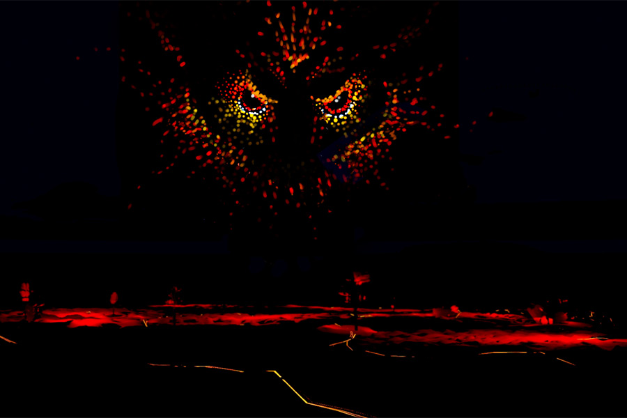
A brilliant blend of the vast landscape elevated by sounds and an array of lights
I first heard about Tjukurpa from a local elder on a previous visit to Uluru. He called it the foundation of the Anangu living cultural landscape associated with the Uluru Kata Tjuta National Park. Many of the First Nations People of Australia like to call themselves custodians and not owners of the land. A philosophy that reflects the zeal to preserve the landscape and culture for the next generation. The UNESCO World Heritage description refers to Tjukurpa is an outstanding example of traditional law and spirituality. It reflects the relationships between people, plants, animals and the physical features of the land. Tjukurpa was founded at a time when ancestral beings, combining the attributes of humans and animals, camped and travelled across the landscape. The actions of these ancestral beings also established a code of behaviour that continues to be followed by Anangu today. Some of these legends play out in Wintjiru Wiru that showcases Uluru in a whole new light. But it still doesn’t match sunrise and sunset at Uluru.
Another view of Uluru at sunrise
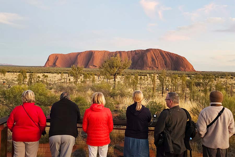
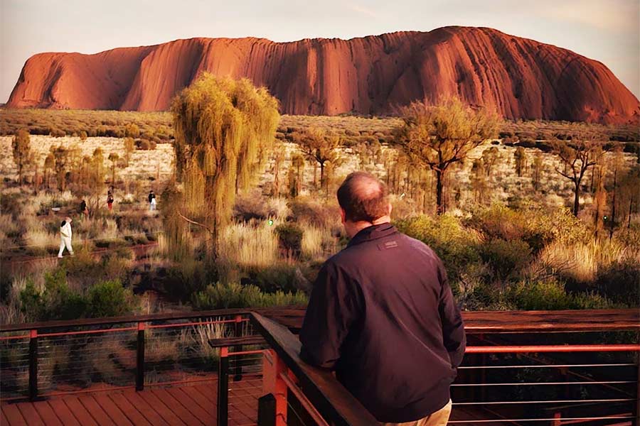
Uluru is truly magnificent at sunset when it briefly goes from dark brown to fiery orange-red, drenched in the last rays of the sun. Add a few clouds and you have the perfect picture. Almost soon after the site was returned to the Pitjantjatjara people in the 1980s, it became a popular climbing site. I heeded to the advice of the local elders and chose not to climb Uluru during my first visit here in 2014. The Pitjantjatjara finally had their way when climbing was banned in 2019. I’d recommend a walk around the base at sunrise or the new Segway tour that circles the base with stops to explore some of the local legends.
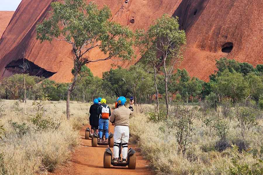
A Segway tour circles the base
The Uluru-Kata Tjuta National Park spread over 1,300sqkm is a six-hour drive from Alice Springs. You can also fly directly into the Uluru/Ayers Rock Airport. The park is not just home to Uluru, but also Kata Tjuta that takes its name from the Pitjantjatjara dialect for ‘Many heads’ and refers to a group of ancient, large domed formations (that geologists call Bornhardts) These 36 domes that cover an area of about 22sqkm are a mix of varying rock types including granite and sandstone. The tallest of these domes is Mount Olga that rises 546 metres above the surrounding plain. This cluster used to be referred to as the Olgas before reverting to its traditional Aboriginal name. The red soil and the arid vegetation present the perfect backdrop for some stunning images. But even this gorgeous grid of 36 domes pales in comparison to Uluru and it’s changing colours.
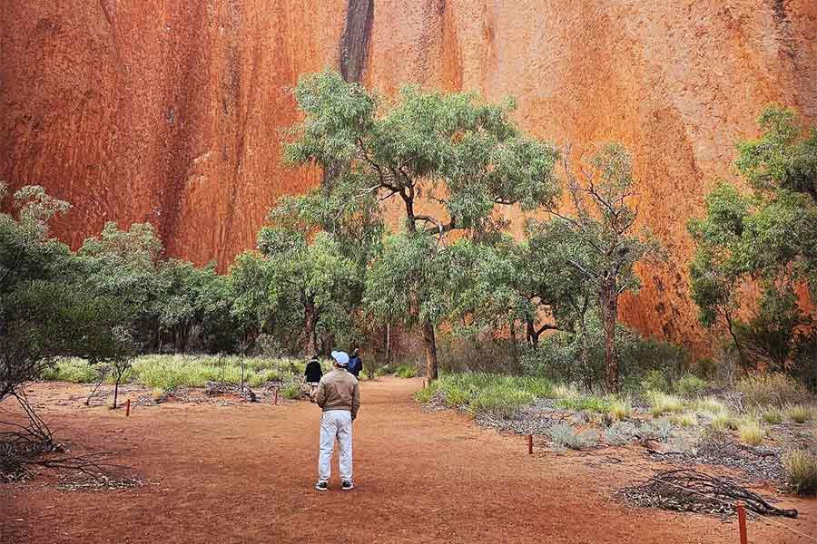
Up close with Uluru
Destinations are what we make them out to be, and there’s a part of me that continues to remain in Uluru. It might be the stories I heard from the local elders or the goosebumps I’ve experienced at sunset. But it’s most likely a case of love at first sight, an unplanned sighting of this fascinating rock formation from an airplane window seat even before I landed in Australia.