Somapura Mahavihara (locally called Paharpur) is a 9th century CE Buddhist Vihar and an UNESCO Heritage Site in Bangladesh. It is located in the Rajshahi division and the surrounding area also houses several other historical sites, including two Buddhist ‘viharas’, a ruined mansion and a couple of memorials related to the first peasant movement of the sub-continent. A whole day tour from Paharpur is required to explore these lesser known historical sites of Rajshahi division of Bangladesh.
Lakma Zamindar Bari
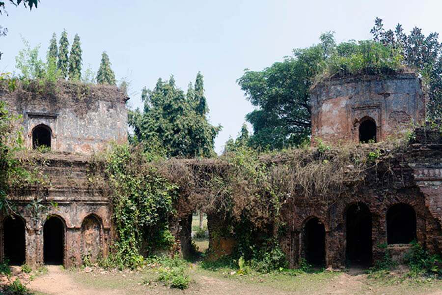
This is located near the town of Panchbibi and is right on the India-Bangladesh border. According to folklore, the ruined mansion was constructed about 250-300 years ago by the local zamindar (landlord) Hadi Mamum Chowdhury. Known as ‘lakma’, their land holding spread across the present-day international border. According to local legend, the zamindars were very cruel and tortured their subjects, this led to a curse forcing them to abandon the mansion. It is not known when the mansion was abondoned. It has been lying in neglect for decades.
The two-storeyed U-shaped mansion has over 25 rooms and is complete with a horse and elephant stable along with servants’ quarters. Sadly, it is in utter ruins with large portions has collapsed and the rest is on the verge of collapse. The last stretch of the road from Panchbibi is not motorable and one needs to walk the last 2km to reach the ruined mansion.
Jagadal Vihar
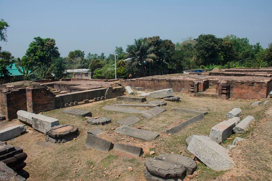
Excavated ruins of Jagadal Vihar
This is a Buddhist ‘vihara’. It was constructed about two centuries after Somapura Mahavihara. Historical records suggest that it was constructed during the reign of Rampala (reign: 1077-1120) of Pala dynasty. The mound below which the ‘vihara’ is buried, is partially excavated. In the last three decades, several archaeological digs have unearthed large portions of the underground structure consisting of several cells and a large hall. The archaeological digs have also revealed several granite pillars, bronze statues of Buddha and several other artefacts. Sadly, large sections of the mound still remain unexcavated covering up a thousand-year-old history.
Dibar Dighi and Stambh
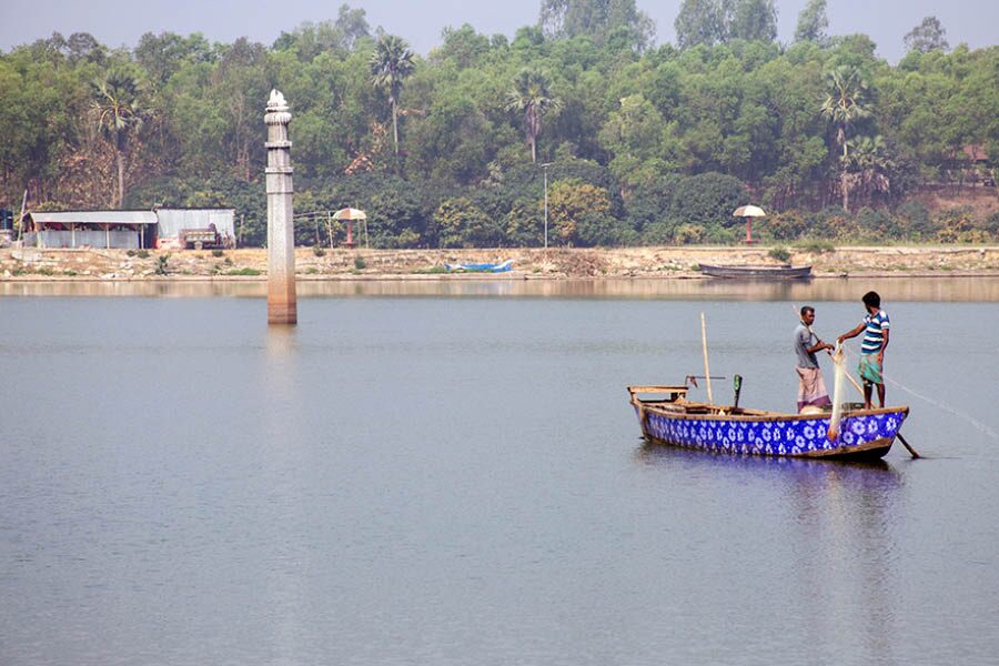
Fishing at Dibar Dighi with Dibar Pillar in the background
This historical pond is located west of Somapura Mahavihara. The square pond with rounded corners houses a partially submerged pillar at the centre of the pond. The name ‘Dibar’ originates from the name of ‘Dibyak’ or ‘Dibya’. He was a local chieftain, who led the Kaivarta (peasant and other lower class people) against the mighty Pala king, Mahipala II (reign: 1070-75). Mahipala II was killed and a large chunk of the Pala kingdom came under Dibak’s control. The revolt was known as the Kaivarta revolt and is often considered as the first peasant revolt in the Indian sub-continent.

Dibyak took control of the Varendra region, which consists of present-day Rajshahi and Rangpur division of Bangladesh along with the districts of Malda and Dinajpur (north and south) of West Bengal. Dibyak was succeeded by his brother, Rudok. Rudok’s son, Bhim, followed. Bhim was finally overthrown by the Pala king, Ramapala (reign: 1077–1130).
Dibar Stambha along with the Dibar Dighi were constructed to mark the victory of the Kaivartas over the mighty Palas. The pillar appears to be built by king Dibyak or his successor, Rudak or Bhim, sometime in the second half of the 11th century. The top of the pillar which probably had a floral motif, but has gone missing. Today, the pond is used for fishing and the boatmen offer a ride to visitors for a close-up look at the octagonal granite pillar.
Bhimer Panti
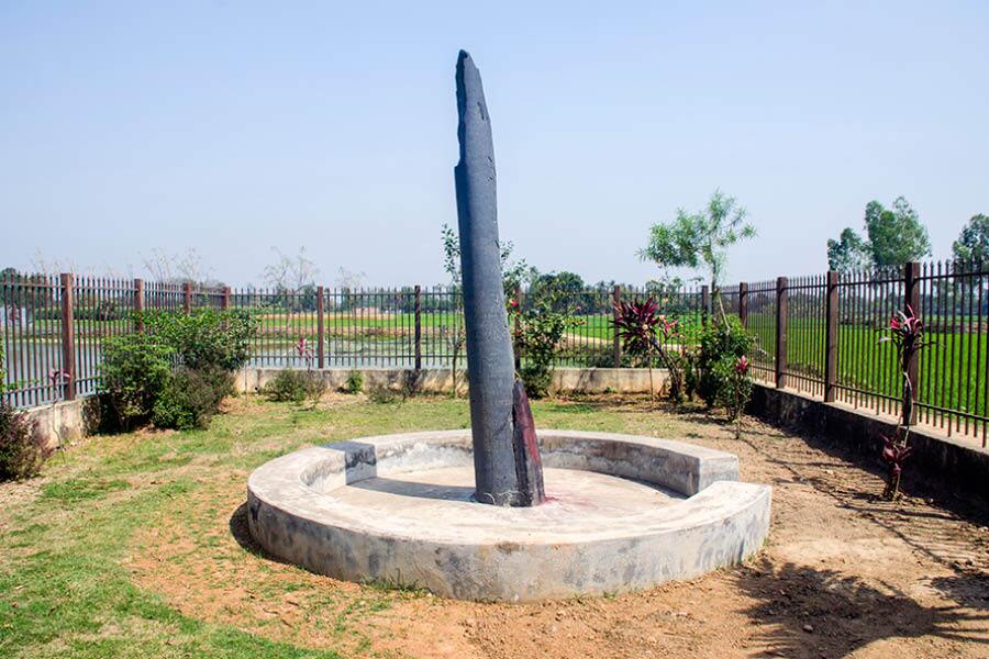
According to local folklore, Bhim used to cultivate the adjoining land at night and moved out before sunrise
The word ‘panti’ refers to a stick carried by the shepherds. Bhimer Panti refers to a stone pillar about 30km north-west of Somapura Mahavihara. Bhim here is referred to as the second Pandava of the Mahabharat. According to local folklore, Bhim used to cultivate the adjoining land at night and moved out before sunrise. One day, he was late, and in a hurry, left his stick behind. No wonder Bhim was a strong man and had a giant stick which resembles a pillar. Locals often connect the pillar with the Kaivarta ruler, Bhim, but an inscription on the pillar tells a different story.
The 28-line inscription mentions the pillar was established by the minister of Pala king Narayanapala (reign: mid 9th-early 10th century CE) and predates Bhim by over a century. Today, the pillar stands in an enclosed complex next to a pond. According to historical records, the pillar was much taller and was topped with a statue of the mythical bird, Gauda. According to locals, the top of the pillar, along with the bird statue, collapsed when the pillar was struck by lightning.
Over the years, the pillar has been vandalised by visitors who have etched their names on stone. A closer inspection of the graffiti will revel some foreign name and some even with dates dating back over two centuries. One of the names is of H Creighton 1786. Henry Creighton was the manager of a nearby indigo factory (whose remains can still be found near Malda, India), but he is known for his painting skills. His paintings still serve as an important source of historical documents. Sadly, its history of the pillar is forgotten and it is being worshipped by the locals using flowers and vermilion.
Halud Vihar
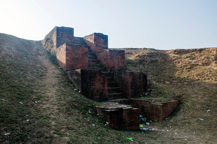
The excavated staircase of Halud Vihar
This is a Buddhist site located about 15km south of Somapura Mahavihara. This again is a large mound stretching about 65m in east to west and 40m in north to south. The highest point towers to a height of 10m. Only small portions of the huge mound have been excavated. Today, a portion of a structure is visible at the top of the mound. It seems to be the base of a large room. A flight of stairs has been dug out from the eastern part of the mound. In 1999, Halud Vihar and Jagadal Vihar have been added to the UNESCO Heritage tentative list.