A sweltering day led to a cloudy evening in Kolkata on Tuesday, raising hopes of thunderstorms like the past two days. But that was not to be.
Adding to the heat torment, Met officials said the wait for the monsoon is likely to get stretched in Kolkata.
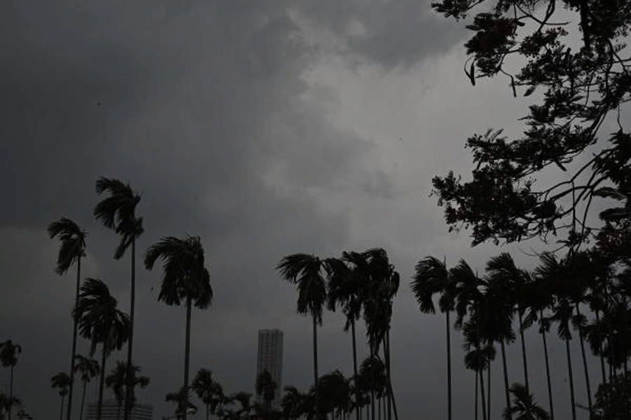
The clouds on Tuesday evening dissipated soon and all the city got were a cool breeze and traces of rain in some areas.
Around 4.46pm, a picture taken from the Maidan showed The 42 standing in the backdrop of a dark skyline. Another picture taken from the same spot, around 5.03pm, showed a much clearer sky.
North Bengal, where the monsoon arrived on Monday, is getting drenched. Kolkata and the rest of south Bengal are getting parched.
“Darjeeling, Jalpaiguri, Kalimpong, Coochbehar and Alipurduar districts have been getting steady rain. Rain is likely to continue there. Some areas might get heavy rain as well. But barring occasional thunderstorms, south Bengal is most likely to be dry,” said G.K. Das, director, IMD, Kolkata.
“The monsoon currents are still weak over the northeast Bay, which is closest to Kolkata. The conditions are unlikely to change very soon. It cannot be said with certainty that the southwest monsoon will reach south Bengal this week,” he said.
The bulk of the moisture from the Bay is going towards north Bengal, which is getting consistent rain.
Biparjoy, a very severe cyclonic storm on the Arabian Sea raging towards the western coast, is also partially responsible for the delayed arrival of the monsoon in south Bengal, said Das.
“Generally, the Arabian Sea and the Bay of Bengal do not host strong systems at the same time. When there is one on any one of them, the other sees a relative calm. Unless the cyclone on the Arabian Sea makes landfall, the monsoon currents over the Bay are unlikely to be strong enough,” he said.
On Tuesday afternoon, Biparjoy was around 300km from the Gujarat coast. It is likely to hit land between Mandvi (Gujarat) and Karachi (Pakistan) on Thursday evening.
On Thursday, the mercury went up in Kolkata and the districts. The maximum temperature was 37.7 degrees Celsius, three notches above normal. Dum Dum and Howrah sizzled at 39 degrees each. Purulia saw the mercury soar to 42.3 degrees.
A cyclonic circulation over Uttar Pradesh and adjoining areas of Bihar is drawing moisture. As a result, clouds took shape over the Jharkhand-Bengal border and moved towards the coast.
“The clouds that came to Howrah and South 24-Parganas were stronger. A lone cloud mass made its way towards Kolkata and lost steam quickly,” said a Met official.