A brief but powerful thunderstorm struck Kolkata on Tuesday evening after the city felt like a cauldron for most of the day.
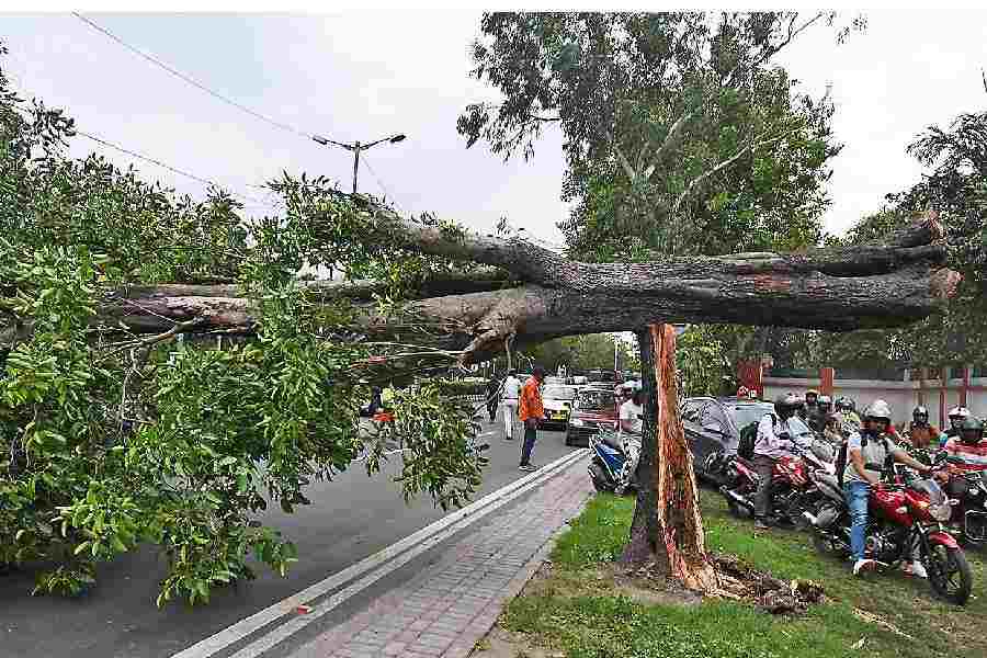
Trees were uprooted at multiple places, stalling traffic for some time.But the rain that followed was negligible. Two flights to Kolkata were diverted.
Thunderstorms reported from the districts were stronger than it was in Kolkata , said a Met official.
The storm clocked 78kmph in Alipore at 5.07pm, the Met office said. Minutes ago, at 5pm, the Met office recorded a wind speed of 72kmph in Dum Dum.
It was not a nor’wester because the clouds that brought the temporary relief from the scorching conditions originated from a cyclonic circulation over Bihar and parts of Uttar Pradesh, the Met office said.
Nor’westers originate over the Chhotanagpur plateau.
The Met office has issued an “enhanced thunderstorm activities” alert from May 23 to 27.
“The next two days in Kolkata are likely to see at least one more thunderstorm, one that is expected to bring more rain than today,” said a Met official.
On Tuesday, the sky started turning grey a little after 4.30pm. Around 5.15pm, the plastic sheets covering the Maidan stalls opposite the Victoria Memorial were dancing in the air as a dust storm lowered visibility.
Trees were uprooted on Kidderpore Road, SN Banerjee Road and Tollygunge Circular Road, said civic and police officials.
Evening traffic was affected in pockets like Chowringhee, JL Nehru Road, AJC Bose Road, Sarat Bose Road and SN Banerjee Road.
Kolkata airport officials said two city-bound flights were diverted as they failed to land because of bad weather. Air India’s Guwahati-Kolkata flight was diverted to Bhubaneswar and IndiGo’s flight from Patna was diverted to Ranchi, an airport official said.
“There is a cyclonic circulation over Uttar Pradesh and Bihar. A trough of low pressure links Uttar Pradesh with Chhattisgarh,” said G.K. Das, director, India Meteorological Department, Kolkata.
“The system led to strong moisture incursion from the Bay and the formation of thunderclouds. The clouds from Bihar travelled to Bengal. That is why the intensity of the storm was more in districts like Malda, North and South Dinajpur, Murshidabad and Birbhum, which also received strong hail storms,” said Das.
Strong thunderstorms were also reported from Bankura, Birbhum and West and East Burdwan. Multiple trees felled in Burdwan town and traffic crawled in the evening.
Das said the cloud mass that moved to Kolkata broke away from a larger mass that was travelling north.
“The cloud had a width of around 7km and was around 5km high from the surface. It was not very strong. That is why the impact was so short-lived,” he said.
In comparison, the clouds that triggered the season’s strongest thunderstorm so far — on May 15, which clocked 84kmph — were at a height of around 12km from the earth’s surface.
Til the storm struck, Kolkatans sweated and fretted as both heat and humidity soared.
The maximum temperature at Alipore was 37.6 degrees, two notches above normal. The maximum and minimum relative humidity were 90 and 51 per cent.
The moisture content in the atmosphere was well over 60 per cent for most of the day, said Met officials.
The districts were warmer. The maximum temperatures at Purulia, Jhargram and Bankura were 42.3, 41 and 40.2 degrees, respectively.