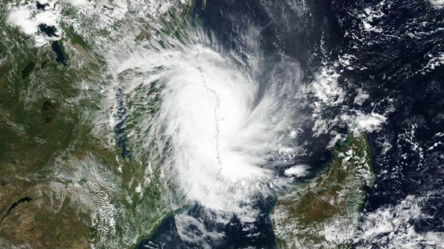
The storm that will turn into Cyclone Jawad is tipped to take a ‘north-northeastwards recurve’ after nearing the Odisha-Andhra coast, the Met office said on Thursday.
The new trajectory points towards the Bangladesh and Bengal coasts but the storm is expected to lose a lot of steam before it has any impact on the coastal areas of the state, said a senior Met official. Any impact in Bengal would be limited to heavy rain in the coastal areas, according to the Met office.
Met officials said there was also a strong possibility that the system would not make landfall as a cyclone. “It might keep moving along the coast but on the sea and by the time the system enters land, it would be a much-depleted one,” said an official of the India Meteorological Department in New Delhi.
The Met bulletin has predicted rainfall across Gangetic Bengal from Saturday to Monday.
On Saturday, “heavy to very heavy” rain is expected in Purba Medinipur, Paschim Medinipur, North and South 24-Parganas, Jhargram and Howrah are likely to get “heavy” rain.
On Sunday, “heavy to very heavy” rain is likely in Kolkata, alongside the above-mentioned coastal districts and “heavy” rain is likely in Purulia, Bankura, Hooghly, Nadia, Birbhum, Murshidabad, Purba and Paschim Bardhaman and Malda.
On Sunday, Bengal’s coastal areas, including Kolkata, are likely to see winds blowing at “40-50kmph”, said an official of the Met office in Alipore.
The system intensified into a well-marked low-pressure area on Thursday morning and a depression in the evening. Around 5.30pm, it was over southeast Bay of Bengal, around 960km from Visakhapatnam in Andhra Pradesh, according to a Met bulletin.
“It was likely to move northwestwards and intensify into a cyclone over central Bay of Bengal by Friday night. It is likely to reach west-central Bay of Bengal off north Andhra Pradesh–south Odisha coasts around 4th December morning. Thereafter, it is likely to move north-northeastwards,” the bulletin said.
Aircraft and ships of the Coast Guard began scanning operations across the waters in Haldia and Diamond Harbour relaying weather warnings in Bengali to mariners and urging fishing boats at sea to return to the harbours as early as possible.
Senior Coast Guard officials said adequate arrangements were being made across the Odisha and Bengal coasts to carry out relief, search and rescue operations across the Bay. “Ships and aircraft will continue to spread the warning on Friday, urging fishermen and boats to return to harbour,” said a senior officer.
“A control room will be in place for coordinating with other agencies including the Indian Air Force, the NDRF and the National Crisis Management Committee,” he said.
Over 50 trains, many of them between Howrah and southern India via Odisha, from Thursday to Saturday, have been cancelled in view of the impending storm, said an official of South Eastern Railway.
The Howrah-Secunderabad Falaknuma Express, Howrah-Hyderabad East-Coast Express and the Howrah-Chennai Central Coromandel Express are among the trains cancelled.
Additional reporting by Kinsuk Basu


