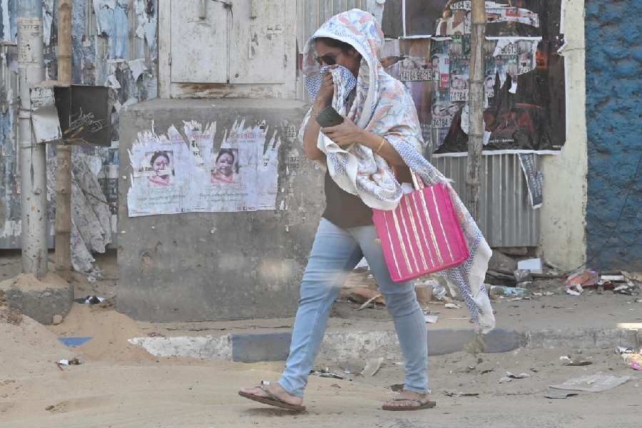
The Celsius shot past 40 degrees in Calcutta after two days on Wednesday.
On Monday and Tuesday, a partial cloud cover led to a slight dip in the day temperature. But Wednesday marked the first day of a renewed heatwave in Calcutta.
According to a Met bulletin issued on Wednesday afternoon, Calcutta will be under the grip of a heatwave till Sunday. At least Sunday, that is.
Met officials tracking satellite and radar images are yet to spot any change in the wind flow that might bring relief to Calcutta any time soon.
Some of the districts, even those neighbouring Calcutta like North and South 24-Parganas, are reeling under a “severe heatwave”.
On Wednesday the Met office recorded a maximum temperature of 40.5 degrees in Alipore.
By the weekend, the day temperature is tipped to reach 42 degrees, the forecast said.
Heating is one of the key ingredients of a thunderstorm. At the moment, it is the only ingredient that the city is not short of.
Metro looks at the prevalent weather conditions and tries to find out what else needs to change for the elusive showers to come to Calcutta.
Wind pattern
Dry westerly and north-westerly winds are likely to dominate the lower levels of the atmosphere for the next four to five days, said the Met bulletin.
“The hot and dry winds usually meet the moist winds from the Bay of Bengal over the mainland, leading to a wind discontinuity. Now, the hot and dry winds are making inroads deep into the Bay, a few hundred kilometres beyond their normal range. The moist winds have weakened considerably and are being pushed further back,” said a Met official.
For the conditions to change, the westerly winds have to lose steam first, he said.
Catalyst
A cyclonic circulation over sub-Himalayan West Bengal and neighbourhood had weakened. As has a trough from the circulation to the north Bay of Bengal.
“No significant synoptic situation prevails over the land area of the
region,” said a Met report.
Another cyclonic circulation lies over northeast Assam in lower tropospheric levels, the Met bulletin said.
The third system is triggering rain in northeastern India. The showers are expected to continue till April 29, according to the bulletin. Some pockets of north Bengal and Sikkim are also likely to get drenched.
Scattered clouds from the other two systems (the circulation and trough over sub-Himalayan Bengal) also triggered light rain in the western districts of Bengal — Purulia and Jhargram — on Monday and Tuesday.
A cyclonic circulation lies over central Maharashtra and another over Telangana in lower tropospheric levels. A trough/wind discontinuity runs from the cyclonic circulation over Telangana to south Tamil Nadu in lower tropospheric levels.
Under its influence, light showers are likely in Maharashtra, Chhattisgarh and Madhya Pradesh. Kerala is also likely to get rain till Saturday.
The same system fed some clouds to Calcutta on Monday and Tuesday when it was over Madhya Pradesh.
“These systems are tools that lift the warm winds so that they reach the lower atmosphere and help in the formation of thunderclouds. For thunderstorms in Calcutta, a trough, wind discontinuity or cyclonic circulation should take shape over Jharkhand or adjoining areas,” the Met official said.
Moisture incursion
An anticyclone over the Bay feeds moisture into south Bengal in the pre-monsoon phase. The system is not static. It keeps oscillating. It is best suited to feed substantial moisture into south Bengal when it is over northwest Bay or north Bay.
“The system has been far south for most of the days this April. As of now, it is near west-central Bay, too far from south Bengal,” said the Met official.
Winds in an anticyclone flow clockwise, just opposite that in a cyclone. “The current position of the anticyclone and the clockwise wind flow mean a chunk of the moisture is not reaching land. Whatever moisture is headed inland is reaching the Northeast,” the Met official said.
The anticyclone has to rise for moisture incursion to intensify in south Bengal, he said.
