A western disturbance passing through mid-tropospheric levels resulted in heavy rain in isolated pockets of Jharkhand since last night.
Rainfall statistics available from IMD's Ranchi Met Centre revealed that as per prediction several places in north-eastern Jharkhand experienced heavy rainfall.
Rajmahal in the Sahibganj district topped the rain chart with heavy rainfall of 80 mm. Borio block in Sahibganj was next to follow with heavy showers of over 65 mm.
Messanjore in Dumka district ( Santhal Pargana) too recorded heavy rain of over 60 mm.
Nandadih in Deoghar district, Kurdeg and Kolebira in Simdega, Sikatia in Godda district, Jamtara, Pakur, Hazaribagh and Ghatshila in East Singhbhum recorded rainfall of over 35 mm.
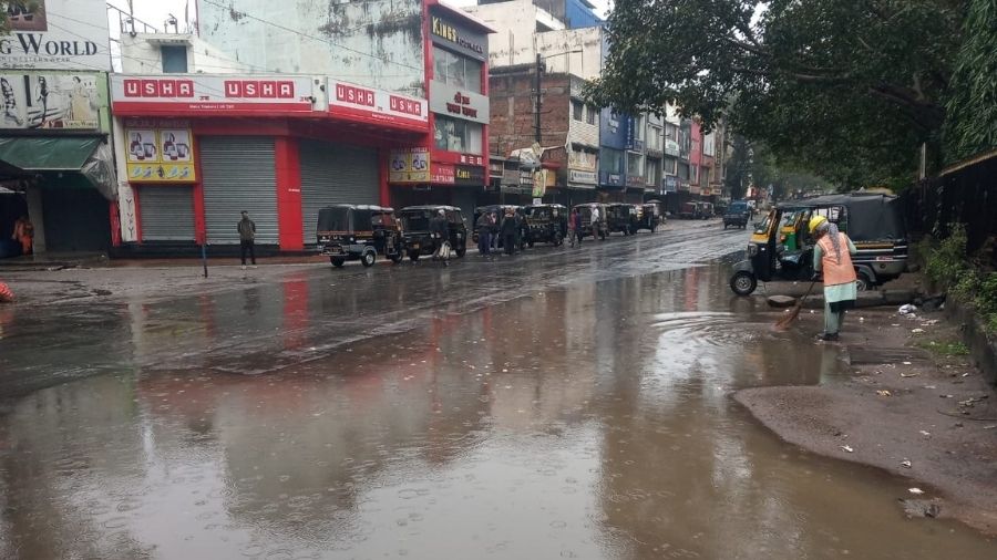
Jamshedpur and its adjoining places like Chaibasa and Chakradharpur in West Singhbhum and Chandil in Seraikela- Kharsawan district recorded around 20 mm rain.
Met data indicated that several other places in central Jharkhand recorded moderate rain since Thursday night.
Most parts of the state including Ranchi and Jamshedpur woke up to inclement weather condition on Friday with intermittent rains.
Due to the influence of the western disturbance, an induced cyclonic circulation also formed over western Rajasthan.
"The system started impacting Jharkhand's weather late in the night as cloud band started reaching north-western and central Jharkhand. We are expecting intermittent rains in several districts today. An alert of thunder and lightning was also issued for isolated areas " Abhishek Anand, head of Ranchi Met Centre.
Some parts of West Singhbhum, Seraikela-Kharsawan and Simdega district also witnessed thunderstorms and lightning activity early on Friday morning.
A north-south trough was also stretched from Bihar to Telengana across Jharkhand and Chhatisgarh extending up to 1.5 Jm above the mean sea level.
The Ranchi Met Centre head Anand, howerver, said that weather conditions would improve tomorrow and that dry weather is expected to prevail from Saturday.
This brought a sigh of relief as the weather official said rain won't mar the Basant Panchami or Saraswati Puja celebrations tomorrow, Saturday.
Today's satellite pictures indicated patches of cloud in most districts of Jharkhand due to the impact of the western disturbance.
Rain coupled with cloud cover and moisture incursion into the atmosphere resulted in an abrupt rise in minimum temperature ( three to four notches above normal) in several places including Ranchi, Jamshedpur, Giridih, Bokaro and Dhanbad.
However, weathermen predicted to fall in minimum readings by 3-5°C during the next 72 hours, with improvement in weather conditions.