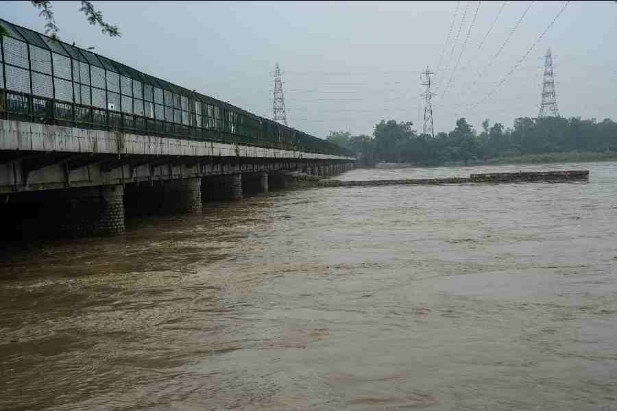
The water level of the Yamuna in Delhi followed a downward trend on Tuesday morning after a slight increase on Monday due to rains in catchment areas upstream of the national capital. However, it is still flowing over two metres above the danger mark of 205.33 metres.
The Wazirabad water treatment plant, where operations were hit due to inundation of a pump house, has also started working at full capacity, Chief Minister Arvind Kejriwal said. According to the Central Water Commission's flood-monitoring portal, the Yamuna water level declined to 205.67 metres by 8 am on Tuesday from 206.01 at 11 pm on Monday.
It is expected to drop further to 205.41 metres by 7 pm.
With the flow rate from the Hathnikund Barrage in Haryana's Yamunanagar decreasing over the past two days, further decline is expected.
The river has been receding gradually after peaking to 208.66 metres on Thursday. However, a minor fluctuation in the water level cannot be ruled out due to rain in the upper reaches. The inundation of a pump house at Wazirabad due to the swollen Yamuna had impeded operations at Wazirabad, Chandrawal and Okhla water treatment plants, leading to a 25 per cent drop in water supply.
The Okhla WTP began operating on Friday, and Chandrawal on Sunday. Kejriwal said in a tweet on Tuesday, "Wazirabad Water treatment plant has also started working at full capacity. Now all WTPs are working at full capacity. DJB worked very hard. Thank you DJB!" Parts of the city have been grappling with waterlogging and flooding issues for a week now. Initially, a downpour caused intense waterlogging on July 8 and 9, with the city receiving 125 per cent of its monthly rainfall quota in just two days.
Subsequently, heavy rains in the upper catchment areas, including Himachal Pradesh, Uttarakhand, and Haryana, led to the Yamuna swelling to record levels.
The river reached 208.66 metres on Thursday, surpassing the previous all-time record of 207.49 metres set in September 1978 by a significant margin.
The river breached embankments and penetrated deeper into the city than it has in over four decades.
Friday marked a turning point as the raging Yamuna and the resulting backflow of foul-smelling water from drains spilled into prominent locations such as the Supreme Court, Raj Ghat, and the bustling intersection at ITO.
Prior to the misery on Friday, the river water had already reached the rear ramparts of the Red Fort and inundated one of the city's major bus terminals at Kashmere Gate.
The Ring Road, constructed partially over floodplains, remained closed for three consecutive days near Kashmere Gate last week.
With the situation deteriorating every passing hour last week, Kejriwal had urged the Centre to intervene and the Delhi Police imposed Section 144 of the CrPC in flood-prone areas to prevent public movement there.
The army was called in for the first time since the 2010 floods to repair a broken flow regulator at drain no. 12, the reason behind the flooding in central parts of the capital on Friday.
The consequences of the floods have been devastating with over 26,000 people evacuated from their homes. The losses incurred in terms of property, businesses, and earnings have amounted to crores.
Experts attribute the unprecedented flooding in Delhi to encroachment on floodplains, extreme rainfall occurring within shorter durations, and silt accumulation that raised the riverbed.
The low-lying areas near the river in the northeast, east, central, and southeast districts, inhabited by around 41,000 people, are considered prone to flooding.
A study on "Urban Flooding and its Management" by the Irrigation and Flood Control Department identifies east Delhi under the floodplain region and highly vulnerable to floods.
Despite this, encroachment and development have occurred at a rapid pace in the ecologically sensitive region over the years.
Letters exchanged between the Delhi Forest Department and the primary land-owning agency in the city, Delhi Development Authority, show that 2,480 hectares of land in the Yamuna floodplains have been encroached upon or developed since 2009.
Except for the headline, this story has not been edited by The Telegraph Online staff and has been published from a syndicated feed.

