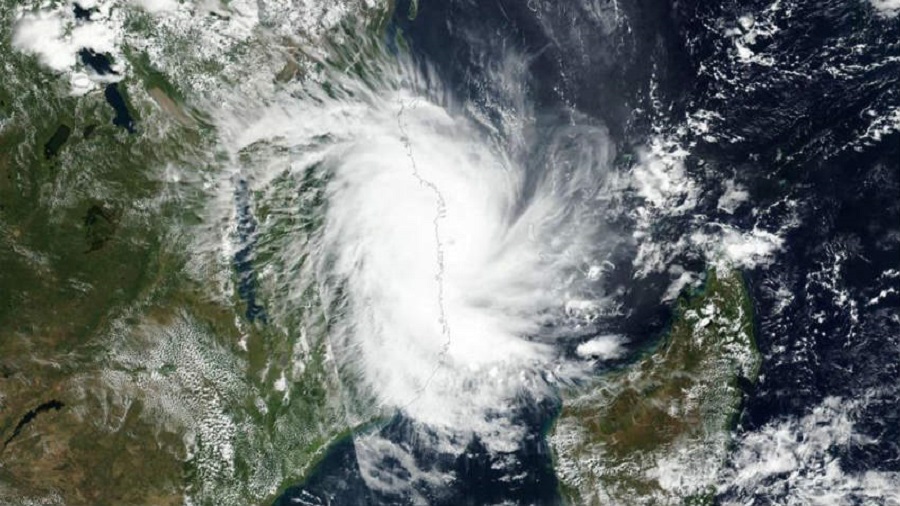
CycloneTauktae is expected to cross the Gujarat coast between Porbandar and Mahuva between 8 pm to 11.30 pm and can cause heavy to very heavy rainfall in isolated parts of the state, the India Meteorological Department said on Monday. Extremely powerful winds with speed up to 185 kilometres per hour - enough to uproot trees and electricity poles - are expected to hit the state.
The Gujarat government has shifted over a lakh people living in coastal areas to safer places after the IMD issued warnings of tidal waves and flooding. Several places in 21 districts received light rainfall due to the cyclone.
The Gujarat government has deployed teams from several departments to provide rescue and relief. Special arrangements have been made in hospitals treating COVID-19 patients to ensure uninterrupted electricity, the government said. Hundreds of ambulances have been kept on standby to shift patients in cases of emergency.
Earlier in the day India Meteorological Department announced that the cyclone had turned into an "extremely severe cyclonic storm", the (IMD) said on Monday.
The rapid intensification happened in the early hours of Monday, said the IMD which had earlier not predicted that Tauktae will intensify into an extremely severe cyclonic storm.
The IMD has, however, forecast that its intensity will reduce when it hits the Gujarat coast.
"The very severe cyclonic storm 'Tauktae' (pronounced as Tau'Te) over eastcentral Arabian Sea moved north-north-westwards with a speed of about 20 kmph during past six hours, intensified into an extremely severe cyclonic storm," the Cyclone Warning Division of the IMD said.
"It is very likely to move north-north-westwards and reach Gujarat coast in the evening hours of 17th and cross Gujarat coast between Porbandar and Mahuva (Bhavnagar district) during the night (2000 2300 hours IST) of May 17 as a very severe cyclonic storm with a maximum sustained wind speed 155-165 kmph gusting to 185 kmph," it added.
Around 1.5 lakh people are being shifted from low-lying coastal areas in Gujarat, while 54 teams of the NDRF and SDRF remained deployed after IMD's warning that Tauktae will reach the state coast on Monday evening and cross it Tuesday.
"The cyclonic storm 'Tauktae' has further intensified into an extremely severe cyclonic storm (ESCS) at 000 UTC and lay centred at 18.5N/71.5E, with a ragged eye," the IMD tweeted Monday morning.
"Very severe cyclonic storm 'Tauktae' over the east-central Arabian Sea intensified into an extremely severe cyclonic storm: cyclone warning and post-landfall outlook for Gujarat and Diu coasts (Red message)," the IMD tweeted.
Skymet, a private company that provides weather forecasts and solutions, said landfall is likely between Gujarat's Mahuva and Porbandar areas and close to Diu.
"A swathe of 100 km on either side of the anticipated strike always remains vulnerable," it said.
In Mumbai, five temporary shelters each have been put up in 24 civic wards of the metropolis so that citizens can be shifted there, if necessary.
The IMD has issued an orange alert for Mumbai, warning of very heavy rains at isolated places with strong winds on Monday as Tauktae is likely to pass close to the Mumbai coast.
Three teams of the National Disaster Response Force (NDRF) stationed in the western suburbs of Mumbai have been put on alert. Teams of the Indian Navy are also kept on standby, officials said.
Meanwhile, in Jalgaon in north Maharashtra, two people died and another was injured after a tree fell on a hut, an official said. It wasn't clear if the incident was directly related to the severity of the cyclonic storm.


