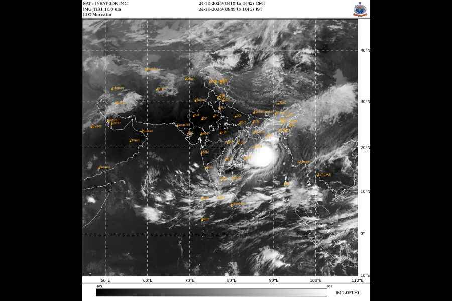
Severe cyclonic storm Dana lay within 200 km of the Odisha coast on Thursday afternoon, as several parts of the state experienced heavy rain and squally winds, with the sea condition remaining rough, the IMD said.
The state government also expedited evacuation efforts in the coastal districts, as Chief Minister Mohan Charan Majhi held a review meeting and directed officials to ensure “zero casualty” due to the natural calamity.
The cyclone is likely to make landfall between Bhitarkanika National Park and Dhamra Port in Odisha early Friday with wind speeds of up to 120 kilometres per hour (kmph), the Met Department said.
The weather system over the Bay of Bengal moved north-northwestwards with a speed of 12 kmph during past the six hours, and lay centred about 210 km southeast of Paradip (Odisha), 240 km south-southeast of Dhamra (Odisha) and 310 km south of Sagar Island (West Bengal), the IMD said its latest bulletin.
“It is very likely to move north-northwestwards and cross north Odisha and West Bengal coasts between Puri and Sagar Island close to Bhitarkanika and Dhamra during midnight of 24th to morning of 25th October as a severe cyclonic storm with a wind speed of 100-110 kmph gusting to 120 kmph,” it said.
Reports about uprooting of trees have been received from some areas of Balasore, Bhadrak, Bhitarkania and Puri, leading to blocked roads, officials said.
Majhi said about three lakh people have been shifted to various cyclone shelters and the operation is continuing.
A total of 7,285 cyclone centres have so far been set up, and 91 medical teams deployed.
The authorities have also engaged 19 teams of the NDRF, 51 teams of the ODRAF and fire services personnel in shifting people and clearing blocked roads, the officials said.
The highest rainfall of 62 mm was recorded at Paradip, while Rajnagar in Kendrapara district received 24 mm rain, in the last four hours, the Met office said.
Moderate to intense rain and thunderstorms with wind speeds of 30-40 kmph are likely to lash some parts of Bhadrak, Balasore, Jajpur, Cuttack, Khurda, Jagatsinghpur, Kendrapada and Puri districts during the day, it said.
Director of the Regional Meteorological Centre, Bhubaneswar, Manorama Mohanty said: “The severe cyclonic storm is likely to re-curve slightly towards west and west-southwards after landfall, triggering rain in southern Odisha around October 26. However, the landfall and wind speed predictions remain unchanged.” Meanwhile, the IMD issued a ‘red warning’ (take action) for heavy to very heavy rainfall in seven districts – Mayurbhanj, Cuttack, Jajpur, Balasore, Bhadrak, Kendrapara and Jagatsinghpur – on Thursday.
An ‘orange warning’ (be prepared to take action) has been sounded in five districts for heavy rain, including Puri, Khurda, Nayagarh and Dhenkanal for the period.
Except for the headline, this story has not been edited by The Telegraph Online staff and has been published from a syndicated feed.


