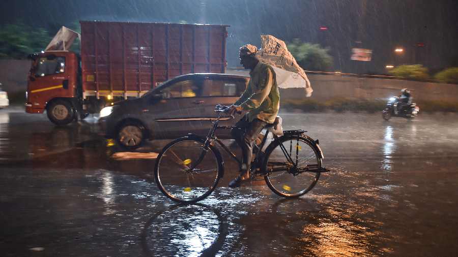
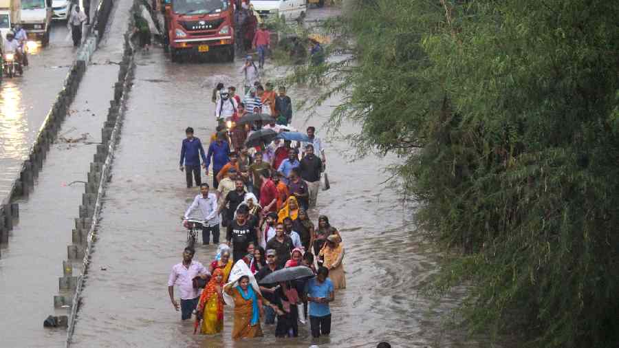
The national capital received the second highest rainfall since 2007 in the last 24 hours till 8.30 am, according to the India Meteorological data on Sunday.
Waterlogging was reported from several areas which led to traffic jams across the city.
The India Meteorological Department, has predicted more rain in the city and its adjoining areas on Sunday.
The city weathered near ceaseless rains measuring 74mm till 8.30 am Sunday that brought the maximum temperature on Saturday down by 10 notches, closing in the day-night temperature gap to a record low.
Incessant rains for the second consecutive day in the national capital improved the air quality on Sunday to "satisfactory" level.
The air quality index recorded at 9 am was 54 which falls in the good category, according to the Central Pollution Control Board data.
The minimum temperature in the national capital settled at 23.4 degrees Celsius, a notch below the season's average, a weather official said.
The difference between minimum temperature (20.8 degrees Celsius) on Friday and maximum temperature (23.4 degrees Celsius) on Saturday was 2.6 degrees Celsius -- the lowest since 1969, the official said.
Earlier, the lowest such margin was recorded on October 19, 1998 at 3.1 degree Celsius, the IMD added.
Relative humidity recorded at 8.30 was 100 per cent, he said.
The Safdarjung observatory, the city's primary weather station, received 74.3 mm rainfall in the last 24 hours. The Palam observatory recorded 64.9 mm rainfall. The Lodhi Road, Ridge, and Ayanagar weather stations received 87.2 mm, 60.1 mm, and 85.2 mm rainfall respectively, the India Meteorological Department (IMD) said.
Rainfall below 15 mm is considered "light", between 15 mm and 64.5 mm "moderate", between 64.5 mm and 115.5 mm "heavy", and between 115.6 mm and 204.4 mm "very heavy". Above 204.4 mm is considered "extremely heavy" rainfall.
The IMD has for Sunday forecast a generally cloudy sky with light rain and thundershowers at few places. The maximum temperature is likely to hover around 24 degrees Celsius.
According to IMD, post-monsoon rain in the area is due to the interactions of a western disturbance which lies as a trough in mid and upper air with a deep trough of easterly wind at a lower level.
According to the weather official, the easterly wind phenomenon is responsible for the very high moisture incursions that cause rains from Arabian Sea across Gujarat and east Rajasthan, spreading up to Uttarakhand crossing Delhi region.
The official explained that the moisture is always available at lower levels, at or near the Earth's surface.
Western disturbance, being the upper air system, always moves west, and helps exacerbate such interactions and ultimately make all rain and clouds move north-eastwards to northeast Uttar Pradesh or Bihar.
"But for sustaining a rain spell for up to two days, those winds have linked from Arabian Sea, and that is exactly happening. In October to March normally, we get 3 to 5 such intense interactions," the IMD official said.


