- PM Modi to hold meeting to review situation related to Cyclone Biparjoy on Monday: Sources, reports PTI
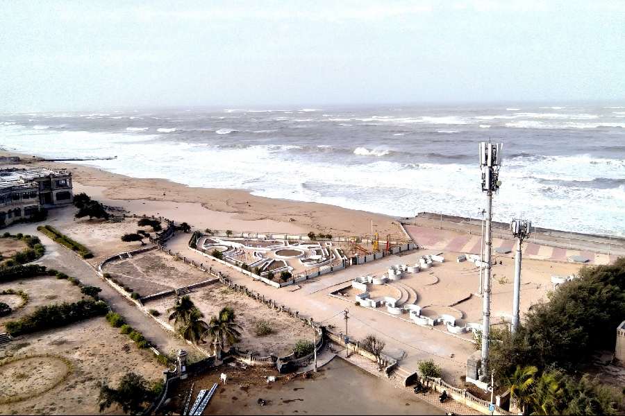
The Gujarat government is deploying NDRF and SDRF teams in coastal areas and will set up shelters in six districts as the extremely severe cyclonic storm Biparjoy is likely to make landfall between Kutch district and Pakistan's Karachi on June 15.
The exact place where the cyclone will make landfall will become clear in the coming days, reports PTI.
Kutch, Jamnagar, Morbi, Gir Somnath, Porbandar, and Devbhumi Dwarka districts are likely to be impacted by the cyclone with heavy rainfall and very high wind speed during June 13-15 which may go up to 150 kmph, an official said on Sunday.
The India Meteorological Department (IMD) said the "extremely severe cyclonic storm 'Biparjoy'" is very likely to cross Saurashtra-Kutch and adjoining Pakistan coasts between Mandvi in Gujarat and Karachi in Pakistan around the noon of June 15 with a maximum sustained wind speed of 125-135 kmph gusting to 150 kmph.
Meanwhile, flight operations in Mumbai were affected on Sunday evening due to inclement weather conditions, with cyclone Biparjoy gushing over the Arabian Sea, reports NDTV. Heavy rain and gusty winds pounded Mumbai as the intensity of cyclone Biparjoy, which has intensified into "extremely severe cyclonic storm", increased.
According to a NDTV report, Mumbai airport witnessed scenes of anxiety and chaos as hundreds of passengers waited for their flights for hours. Several flights were cancelled or delayed owing to the weather conditions, while some were forced to abort the landing.
Gujarat Chief Minister Bhupendra Patel has held a meeting with collectors of coastal districts, representatives of the Army, Navy and Indian Coast Guard and officials of various departments, Relief Commissioner Alok Pandey told reporters.
He said officials of various departments have been directed to prepare in advance to mitigate the impact of the cyclone in coastal districts and establish coordination to keep casualties to the minimum.
Teams of the National Disaster Response Force (NDRF) and State Disaster Response Force (SDRF) are being deployed along the coastal areas and various departments including fisheries, health and agriculture have been asked to work in coordination, Pandey said.
The government will set up shelter houses in the six districts for those residing within a 5-10 km radius of the coastline who will be shifted to safer places.
"At the meeting, the chief minister has directed all the departments to carry out maximum possible relief and rescue works in coordination with collectors of coastal districts likely to be affected by the cyclone," said Pandey.
The CM has assigned the responsibility of coastal districts to senior ministers who will guide the local administration to plan and undertake disaster management works considering the possible impact of the cyclone.
The chief minister instructed Rishikesh Patel, Kanubhai Desai, Raghavji Patel, Kuvarji Bavaliya, Mulu Bera, Harsh Sanghvi, Jagdish Vishwakarma and Parasottam Solanki to reach their assigned districts, the Chief Minister's Office said in a statement.
The IMD has issued heavy rainfall warnings for Kutch, Devbhumi Dwarka, Porbandar, Jamnagar, Rajkot, Junagadh and Morbi districts on June 14 and 15.
On June 14, the intensity of rainfall is likely to increase to "heavy to very heavy '' in a few places and "extremely heavy '' at isolated places over the affected districts on June 15. The remaining districts of Saurashtra and north Gujarat regions are also likely to witness very heavy rainfall on that day, the IMD bulletin said.
Wind speed along and off Saurashtra and Kutch coasts will reach 50-60 kmph gusting to 70 kmph from June 13-14.
A wind speed of 65-75 kmph gusting to 85 kmph is very likely to prevail from the evening of June 14 before reaching a speed of 120-130 kmph gusting to 145 kmph from the morning of June 15 for the subsequent 12 hours, the IMD said.
At 4:30 pm on Sunday, the extremely severe cyclonic storm “Biparjoy” over east central Arabian Sea moved northeastward with a speed of 8 kmph.
It lays centred about 550 km west of Mumbai, 450 km south-southwest of Porbandar, 490 km south-southwest of Dwarka and 570 km south-southwest of Naliya in Kutch and 750 km south of Karachi in Pakistan, the Met department said.
Air India late last evening put out a statement saying some of its flights running from Mumbai will be delayed due to bad weather and temporary closure of the runway.
The weather office has issued a 'thunderstorm' alert for some districts in coastal Maharashtra.
Sea conditions along and off the Saurashtra and Kutch coast are likely to remain "rough to very rough" till Wednesday, and very rough to high on Thursday, it said.
The IMD has advised total suspension of fishing operations in the region till June 15. It has advised fishermen to not venture into the central Arabian sea till Thursday, the north Arabian sea during June 12-15, and along and off Saurashtra-Kutch coasts till June 15.
It has further advised those out at sea to return to the coast and regulate offshore and onshore activities judiciously.
"In view of the above, the state governments are advised to keep a close watch, monitor the situation in their areas regularly and take appropriate precautionary measures. District authorities are advised accordingly," the IMD said.
A cyclone moving over the land after its intensification in the ocean is said to make landfall when the centre of the storm (eye) moves across the coast.
Except for the headline, this story has not been edited by The Telegraph Online staff and has been published from a syndicated feed.


