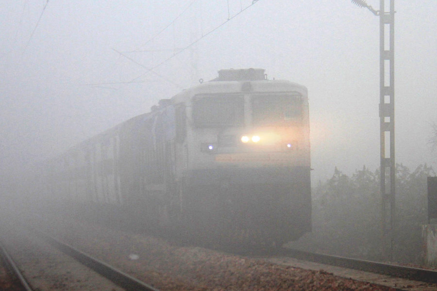
A layer of fog lowered visibility to zero metres at several places in north and northeast India, affecting rail traffic, officials said.
Satellite imagery showed some reduction in fog over Bihar and eastern Uttar Pradesh.
However, ‘dense’ to ‘very dense’ fog prevailed in parts of Punjab, Haryana, west Rajasthan, Bihar, Delhi, west Uttar Pradesh, Jharkhand, Odisha and Assam.
A spokesperson for the Indian Railways said 18 trains arriving in Delhi were delayed by up to six hours due to foggy weather.
At 5:30 am, visibility levels stood at 25 metres in Patiala, Amritsar, Ambala, Hisar, Bikaner and Purnia and 50 metres in Churu, Ganganagar, Jhansi, Ranchi, Paradip and Lakhimpur.
At the Palam Observatory near the Indira Gandhi International (IGI) Airport in Delhi, visibility was limited to only 50 metres.
However, it improved to 350 metres by 8:30 am.
Early-morning foggy weather in north and northeast India has heavily impacted road, rail and air traffic over the last fortnight.
The IMD said 'dense' to ‘very dense’ fog and 'cold day' to 'severe cold day' conditions are likely to prevail over north India for the next five days.
"Cold wave to severe cold wave conditions are likely to continue over northwest India for five days," it said.
In the plains, the MeT office declares a ‘cold wave’ if the minimum temperature dips to 4 degrees Celsius or when the minimum temperature is 10 degrees or below and is four-and-a-half notches below the normal.
A ‘severe cold wave’ is when the minimum temperature dips to 2 degrees Celsius or the departure from the normal is by more than 6.4 degrees.
A ‘cold day’ is when the minimum temperature is less than or equal to 10 degrees Celsius below normal and the maximum temperature is at least 4.5 degrees below normal.
A ‘severe cold day’ is when the maximum is 6.5 degrees Celsius or more below normal.
Except for the headline, this story has not been edited by The Telegraph Online staff and has been published from a syndicated feed.


