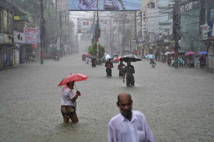
India on Thursday described as factually incorrect reports in Bangladesh that the current flood situation in certain parts of the country has been caused by the opening of a dam on the Gumti river in Tripura.
The Ministry of External Affairs (MEA) said floods in the common rivers between the two countries are a "shared" problem inflicting sufferings to people on both sides, and requires close mutual cooperation towards resolving it.
"We have seen concerns being expressed in Bangladesh that the current situation of flood in districts on the eastern borders of Bangladesh has been caused by opening of the Dumbur dam upstream of the Gumti river in Tripura. This is factually not correct," the ministry said.
"We would like to point out that the catchment areas of the Gumti river that flows through India and Bangladesh have witnessed heaviest rains of this year over the last few days," it added.
The MEA said the flood in Bangladesh has been caused primarily due to waters from these large catchments downstream of the dam.
The Dumbur dam is located quite far from the border -- more than 120 km upstream of Bangladesh -- the ministry said in a statement.
"It is a low-height (about 30 metre) dam that generates power that feeds into a grid and from which Bangladesh also draws 40MW power from Tripura," the MEA noted.
"Along the about 120-km river course, we have three water-level observation sites at Amarpur, Sonamura and Sonamura 2," it said.
Heavy rainfall has been continuing since August 21 in the whole of Tripura and the adjoining districts of Bangladesh.
In the event of heavy inflow, automatic releases have been observed, the MEA said, adding that the Amarpur station is part of a bilateral protocol under which India transmits real-time flood data to Bangladesh.
"Data showing rising trend has been supplied to Bangladesh up to 1500 hours on August 21. At 1800 hours, due to flooding, there was power outage, leading to problems of communication," it said.
"Still, we have tried to maintain communication through other means created for urgent transmission of data," it noted.
The MEA said the two countries share 54 common cross-border rivers and river-water cooperation is an important part of the bilateral engagement.
"We remain committed to resolving issues and mutual concerns in water resources and river water management through bilateral consultations and technical discussions," it said.
Except for the headline, this story has not been edited by The Telegraph Online staff and has been published from a syndicated feed.


