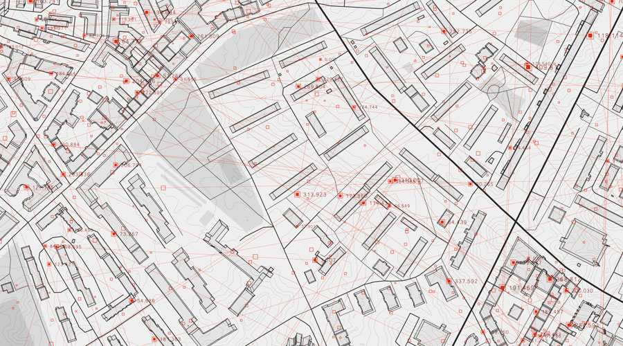
Indian entities would no longer need government approvals to collect and offer geospatial data, high-resolution maps, and street views of physically accessible areas across the country under new guidelines announced by the Union science and technology ministry on Monday.
The guidelines for geospatial data — topographic information about features and objects across a terrain — are intended to liberalise data collection and use by removing constraints and regulatory approvals without diluting security concerns, top ministry officials said.
“Map-making in India stands completely deregulated from today,” Jitendra Singh, minister of state for the departments of atomic energy and space and the Prime Minister’s Office, said.
Under the guidelines, Indian entities would no longer require prior approvals, security clearances, or licences for the acquisition and production of geospatial data, including high-accuracy maps and surveys of street views and territorial waters at finer than 1m horizontal and 3m vertical resolutions. Such data would need to be stored within the country.
“If an area is physically accessible, there would be no further restrictions on surveying and mapping there,” science and technology secretary Ashutosh Sharma said. But sensitive installations would not be marked on the maps.
Experts have welcomed the guidelines saying restrictions and requirements for approvals had until now hampered domestic growth of the geospatial data sector that has potential applications in myriad areas — from navigation, business, and governance to healthcare and tourism.
“This could potentially allow an Indian company to offer similar map-based services and street views the way Google does,” said Rahul Chopra, a Pune-based specialist in applications of geospatial data.
The Centre had rejected a proposal submitted by Google in July 2015 to provide its street view service in India. The service allows users to explore locations through 360-degree panoramic street-level imagery and view public areas — from shopping centres to tourist spots.
The new guidelines also specify that all geospatial data generated using public funds, except classified geospatial data, would become available for scientific, economic and developmental purposes to “all Indian entities without restrictions”. Sharma said foreign entities could license but not be able to own fine (high accuracy) data.
“The earlier restrictions primarily due to security concerns had meant the country’s entire coastline was beyond the reach of mappers,” Chopra said. “With those restrictions gone, we could look forward to the growth of applications in sectors such as real estate or business or healthcare.”
Geospatial data, for instance, could be used to track the growth rate of towns and cities, to develop population maps that businesses could use to rely on to plan their growth or to map healthcare establishments across cities or states.
Industry analysts expect the guidelines to help expand India’s geospatial economy which currently is estimated to be worth Rs 25,000 crore and employing 250,000 people.
“With these guidelines, we expect the domestic geospatial economy to grow to Rs 50,000 crore by 2025,” said Sanjay Kumar, the chief executive with Geospatial Media and Communications.
Earlier, amid the restrictions or no clear rules, Kumar said, “the industry had to operate in a grey zone and that kept major companies at bay.”