The deep depression over the Bay of Bengal crossed the Odisha coast close to Puri on Monday, the Indian Meteorological Department (IMD) said.
Manorama Mohanty, director of the Regional Meteorological Centre in Bhubaneswar, said, "The landfall process for any system, whether a depression or a cyclone, takes time. The current system made a landfall between 10.30 am and 11.30 am with wind speeds between 55 km/hour and 65 km/hour." A deep depression is a more intense stage of a low-pressure system and precedes the formation of a cyclonic storm. The progression towards a cyclone involves several stages - a well-marked low pressure, a depression, deep depression, and finally a cyclonic storm, the IMD added.
In its 11:15 am bulletin, the IMD said, "The system is very likely to move nearly northwestwards and cross the coast near Puri in the next three hours before continuing northwestwards across Odisha." The IMD anticipates that the system will maintain its deep depression intensity until the evening, then gradually weaken into a depression by midnight on September 9. Afterward, it is expected to move west-northwestwards across Chhattisgarh over the next 24 hours.
While a 'red alert' has been issued for five districts - Puri, Jagatsinghpur, Khurda, Cuttack, and Dhenkanal - the IMD has warned of scattered heavy to very heavy rainfall with isolated extremely heavy rainfall in Ganjam, Koraput, Kandhamal, Bolangir, Bargarh, Boudh, Sonepur, Jajpur, Kendrapara, Sambalpur, Angul, and Nayagarh districts.
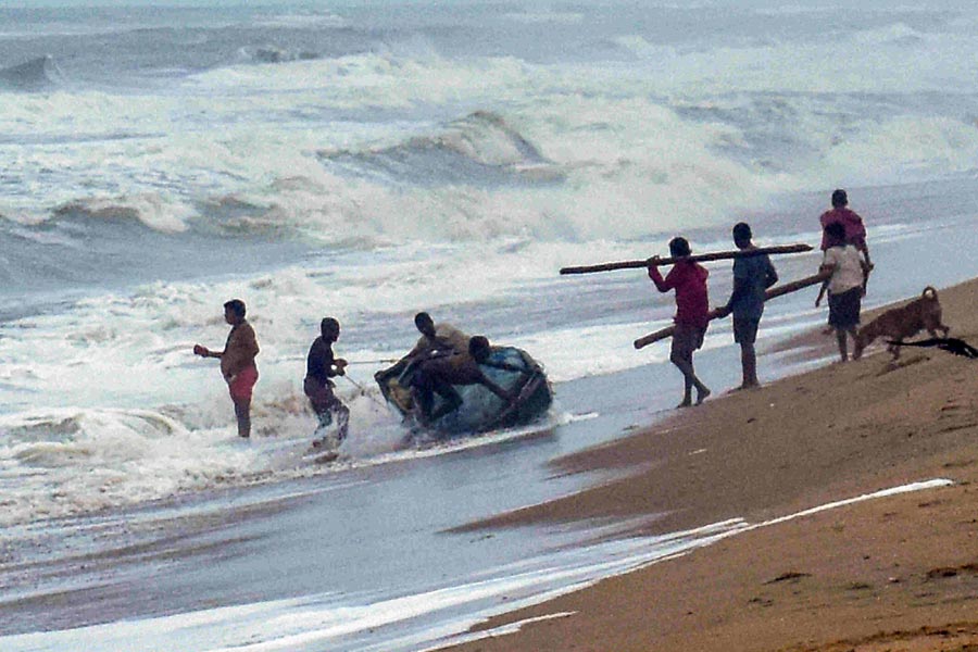
Fishermen have been advised not to venture into the sea until September 11, the IMD said.
Meanwhile, reports of flash floods were received from Malkangiri and Koraput districts. While a huge area in Malkangiri has been inundated, rainwater was flowing above four feet at places at several places on NH-326, weathermen said.
Potteru town in Malkangiri has been heavily inundated due to continuous rain over the past three days.
A landslide near Valve House Chhak has blocked a main road, disrupting communication between Chitrakonda block, Malkangiri, Jeypore, and neighboring Andhra Pradesh. In Koraput, 25 villagers were evacuated from Digapur panchayat on Sunday due to flash floods caused by persistent rainfall.
Low-lying areas in Ganjam, Rayagada, and Gajapati districts have also experienced waterlogging from the depression-induced rainfall since Saturday. Chief Secretary Manoj Ahuja reviewed the situation on Sunday night and directed all district collectors to stay vigilant and evacuate residents from vulnerable low-lying areas.
Special Relief Commissioner (SRC) DK Singh said the government has rushed IAS officer BP Sethi and IPS officer Sanjay Kumar to Malkangiri in wake of the flash floods.
The SRC said 18 teams of Odisha Disaster Rapid Action Force have been deployed in the districts of Malkangiri, Koraput, Rayagada, Ganjam, Kandhamal, Boudh and Bolangir district to help in relief operations.
The National Disaster Response Force (NDRF) has deployed six teams in Ganjam, Puri, Khurda and Nayagarh for relief operations.
Except for the headline, this story has not been edited by The Telegraph Online staff and has been published from a syndicated feed.