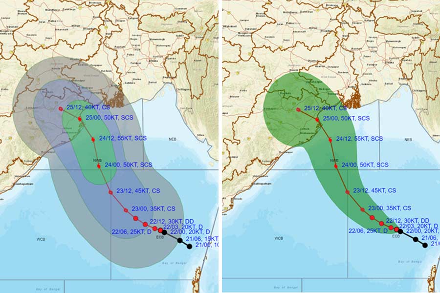
The depression over east-central Bay of Bengal, which is expected to spark cyclone Dana, moved west-northwestwards with a speed of 6 kmph during the past three hours, the India Meteorological Department said at 1pm on Tuesday.
The depression lay centred at 0830 hrs IST of Tuesday, October 22, over the same region near latitude 15.5° N and longitude 91.0°E, about 700 km southeast of Paradip (Odisha), 750 km south-southeast of Sagar Island (West Bengal) and 730 km south-southeast of Khepupara (Bangladesh).
“It is very likely to move west-northwestwards and intensify into a cyclonic storm by 23rd October, 2024 over east-central Bay of Bengal,” the IMD posted on its X (formerly Twitter( handle.
“Thereafter, continuing to move northwestwards, it is very likely to intensify into a severe cyclonic storm over northwest Bay of Bengal by morning of 24th and cross north Odisha and West Bengal coasts between Puri and Sagar Island during night of 24th and morning of 25th October, 2024 as a severe Cyclonic Storm with a wind speed of 100-110 kmph gusting 120 kmph,” the post added.
Advising fishermen not to venture into the sea from October 23 to 25, the IMD had earlier warned that wind speed is likely to reach 60 kmph along and off Odisha-West Bengal coasts and gradually increase thereafter.
The storm is likely to bring very heavy rainfall in southern West Bengal districts on October 24 and 25, the IMD has said.
The weather system will bring heavy to very heavy rainfall with extremely heavy downpours at one or two places in the districts of South 24 Parganas, Paschim Medinipur, Purba Medinipur and Jhargram.
Heavy to very heavy rainfall is likely in Kolkata, Howrah, Hooghly, North 24 Parganas, Purulia and Bankura districts between October 24 and 25.


