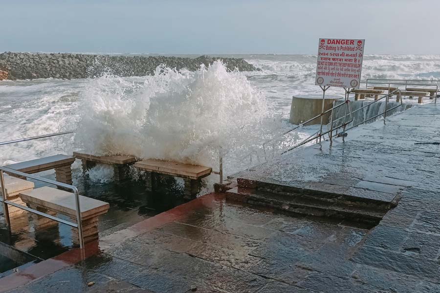
Authorities have so far shifted 50,000 people from coastal areas of Gujarat to temporary shelters ahead of the expected landfall of powerful cyclone 'Biparjoy' near Jakhau port in Kutch district.
With the cyclone barrelling towards the Gujarat coast, parts of the Saurashtra-Kutch region received heavy rains accompanied by strong winds, the Met department said on Wednesday.
The cyclone is expected to make landfall on Thursday evening as a "very severe cyclonic storm" with maximum wind speed reaching up to 150 kilometres per hour, the India Meteorological Department (IMD) said.
In the 24 hours ending Wednesday morning, Khambhaliya taluka of Devbhumi Dwarka district received the highest 121 mm of rainfall, followed by Dwarka (92 mm) and Kalyanpur (70 mm) during this period, the State Emergency Operation Centre (SEOC) said in a release.
More than nine talukas in Jamnagar, Junagadh, Rajkot, Porbandar and Kutch districts received more than 50 mm of rainfall in the same period, it said.
According to SEOC, 54 talukas across the districts of Saurashtra and Kutch received more than 10 mm of rainfall in the last 24 hours till Wednesday morning.
"The cyclone is nearly 290 km away from Kutch at present. As a precautionary measure, we have already shifted nearly 50,000 people living in coastal areas to temporary shelters. The evacuation process is still on and the remaining 5,000 persons will be shifted by this evening to safer places" said State Commissioner of Relief, Alok Kumar Pandey.
Of the 50,000-odd evacuees, nearly 18,000 people were shifted to shelters in Kutch district while others were evacuated from Junagadh, Jamnagar, Porbandar, Devbhumi Dwarka, Morbi and Rajkot, Pandey told reporters in Gandhinagar.
He said 15 teams of NDRF (National Disaster Response Force), 12 teams of SDRF (State Disaster Response Force), 115 teams of state road and building department, and 397 teams of the state electricity department have been deployed in different coastal districts.
"Officials of departments of Electricity and Road & Building have also reached designated spots to restore connectivity and power supply. We have also deployed teams carrying HAM Radio sets and satellite phones in the coastal region for better communication," said Pandey.
Chief Minister Bhupendra Patel visited the state government’s emergency operations centre on Tuesday night for a review of the preparedness.
The IMD said in a bulletin that the intensity of rainfall would increase as the cyclone approaches the Gujarat coast on June 15, with isolated places in the districts of Kutch, Devbhumi Dwarka and Jamnagar likely to witness extremely heavy rains.
Cyclone Biparjoy is very likely to cross Saurashtra and Kutch and adjoining Pakistan coasts between Mandvi (Gujarat) and Karachi (Pakistan) near Jakhau port (Gujarat) by the evening of June 15 as a very severe cyclonic storm with maximum sustained wind speeds of 125-135 kmph gusting to 150 kmph, it said.
Due to this, a few places in Porbandar, Rajkot, Morbi, Junagadh and the remaining districts of Saurashtra and North Gujarat region are also likely to receive heavy to very heavy rainfall on Thursday.
The IMD has also forecast light to moderate rainfall with heavy to extremely heavy rainfall at isolated places over north Gujarat districts and adjoining south Rajasthan on Friday.
Wind speeds will reach 65-75 kmph gusting to 85 kmph along and off the coasts of the districts of Porbandar and Devbhoomi Dwarka from Wednesday forenoon, the IMD said.
They will gradually increase to 125-135 kmph gusting to 150 kmph on Thursday along and off the districts of Kutch, Devbhumi Dwarka, Porbandar, Jamnagar, Rajkot, Junagarh and Morbi.
Sea condition is likely to be very rough till the evening of Wednesday along Saurashtra and Kutch coasts and high to phenomenal till the evening of Thursday before becoming normal, the IMD said.
A storm surge of about 2-3 m above the astronomical tide is likely to inundate low-lying areas of the affected districts during the time of landfall. The tides could be up to 3-6 meters in different places, the Met department said.
Except for the headline, this story has not been edited by The Telegraph Online staff and has been published from a syndicated feed.


