The storm in the Bay of Bengal intensified into a cyclone on Sunday, packing wind speed of more than 75 kmph, and is expected to get stronger, the weather office said.
However, it is expected to fizzle out next week without making a landfall.
Under the influence of the cyclone, northern Andhra Pradesh and Odisha coasts are expected to experience heavy winds and rains from Tuesday, the weather office said.
The cyclonic storm 'Asani', Sinhanlese for 'wrath', lay centred over southeast Bay of Bengal 380 km west of Port Blair in the Andaman Islands at 5:30 am on Sunday, the weather office said.
It is very likely to move northwestwards and intensify further into a Severe Cyclonic Storm over east central Bay of Bengal during the next 24 hours, the India Meteorological Department (IMD) said in a bulletin issued at 8:30 am.
According to the track of the cyclone forecast by IMD, the cyclone was very likely to continue to move northwestwards till May 10 evening and reach West central and adjoining Northwest Bay of Bengal off North Andhra Pradesh and Odisha coasts.
Thereafter, it is very likely to recurve north-northeastwards and move towards Northwest Bay of Bengal off Odisha coast, it said.
According to the cyclone trackers, the weather system is expected to be at its strongest, packing wind speed of 60 knots (111 km per hour), on Monday with its fury on full display in the Bay of Bengal.
The severe cyclonic storm is expected to start weakening gradually from Tuesday as it moves towards the coasts of northern Andhra Pradesh and Odisha.
Coastal districts of Odisha and the southern part of West Bengal, including the state capital Kolkata, are likely to be lashed by light to moderate rain from Tuesday, the IMD said.
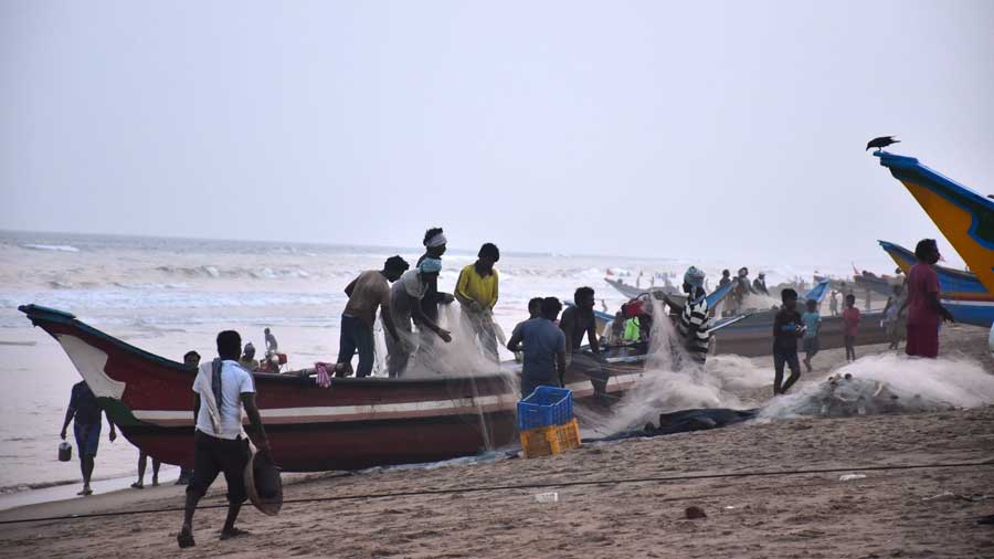
Fishermen have been advised not to venture into the sea and along and off West Bengal and Odisha coasts from May 10 till further notice.
The sea conditions near the Odisha coast will become rough on May 9 and rougher on May 10. The wind speed in the sea will increase to 80-90 kmph on May 10.
Bay of Bengal cyclone to intensify into severe storm "Asani", will move parallel to east coast
The deep depression over Southeast Bay of Bengal Sunday moved west-northwestwards with a speed of 16 kmph during the past 6 hours and intensified into a cyclonic storm Asani' (pronounced as Asani) , IMD said.
The system lay centered at 5.30 AM over Southeast Bay of Bengal, about 450 km west-northwest of Car Nicobar (Nicobar Islands), 380 km west of Port Blair (Andaman Islands), 970 km southeast of Visakhapatnam (Andhra Pradesh) and 1030 km south-southeast of Puri (Odisha).
It is very likely to move northwestwards and intensify further into a severe cyclonic storm over east central Bay of Bengal during next 24 hours, the India Meteorological Department said adding that the system is very likely to continue to move northwestwards till May 10th evening and reach West-central and adjoining Northwest Bay of Bengal off North Andhra Pradesh and Odisha coasts.
Thereafter, it is very likely to recurve north-northeastwards and move towards Northwest Bay of Bengal off Odisha coast.
The IMD DG Mrutunjay Mohaptra has on Saturday made it clear the cyclone was unlikely to make landfall either in the coast of Odisha or Andhra Pradesh, but will move parallel to the coast in the sea.
The IMD in its latest bulletin said that the the system will remain in the form of a cyclonic storm till Sunday evening and later intensify into a severe cyclonic storm and will continue to remain in this form till May 10 night. Subsequently, it will lose steam in the sea and become another cyclonic storm on May 11 and 12.
While the maximum speed limit on May 8 will remain at 60 to 70 kmph, gusting to 80 kmph, its speed may increase to 90 to 100 kmph with gusting up to 110 kmph by Sunday afternoon and then speed up by evening to reach 95 to 105kmph with gusting to 115 kmph.
On May 9th, the wind speed will be 105 to 115 gusting 125 kmph and then the storm is expected to lose stream in the sea on May 10 with wind speed coming down to 96-105 gusting 115 in the early hours reducing progressively as the day wears off.
Meanwhile, Odisha government said it has not lowered guards even after getting information that the cyclone will not hit the state's coast. The state was prepared to evacuate 7.5 lakh people if need be, Special Relief Commissioner P K Jena said.