Cyclone Dana, intensifying over the Bay of Bengal, will hit Odisha and West Bengal coasts between the night of October 24 and the morning of October 25, 2024. With wind speeds predicted to reach 100–110 km/hour and gusting up to 120 km/hour, Dana is expected to cause heavy to extremely heavy rainfall in several districts, impacting daily life, especially train services and flight operations.
The Calcutta airport authorities have suspended flight operations for 15 hours from 6 pm on Thursday in view of the impact of cyclone Dana, according to an Airports Authority of India (AAI) official.
The Eastern Railway will not operate 190 local trains in its Sealdah division from 8 pm on Thursday till 10 am on Friday in view of cyclonic storm ‘Dana’, an official said.
The authorities have taken these steps for the safety of passengers, airline employees, various equipment, navigational aids and infrastructure taking flights and as a precautionary measure to ensure the safety of train passengers.
These suburban train cancellations will cause major disruptions for commuters in key districts, including Kolkata, North and South 24 Parganas, Howrah, Nadia, and Murshidabad.
Authorities have urged commuters to plan alternative travel options.
The last EMU trains in the Sealdah Division will depart between 6 PM and 8 PM on October 24.
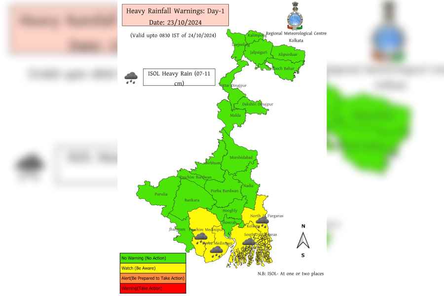
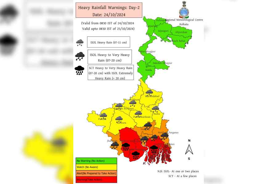
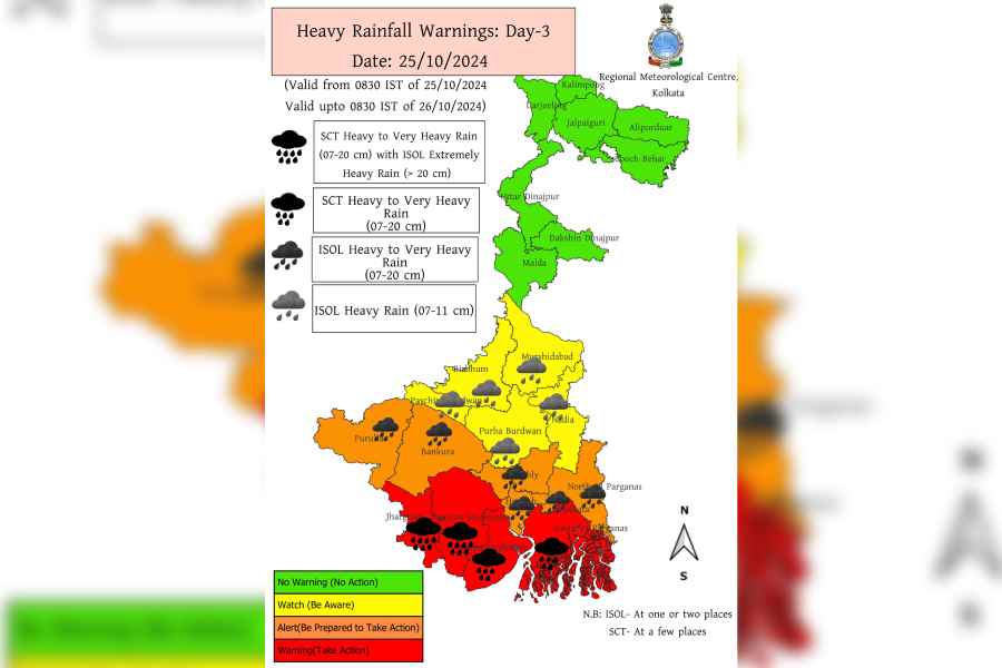
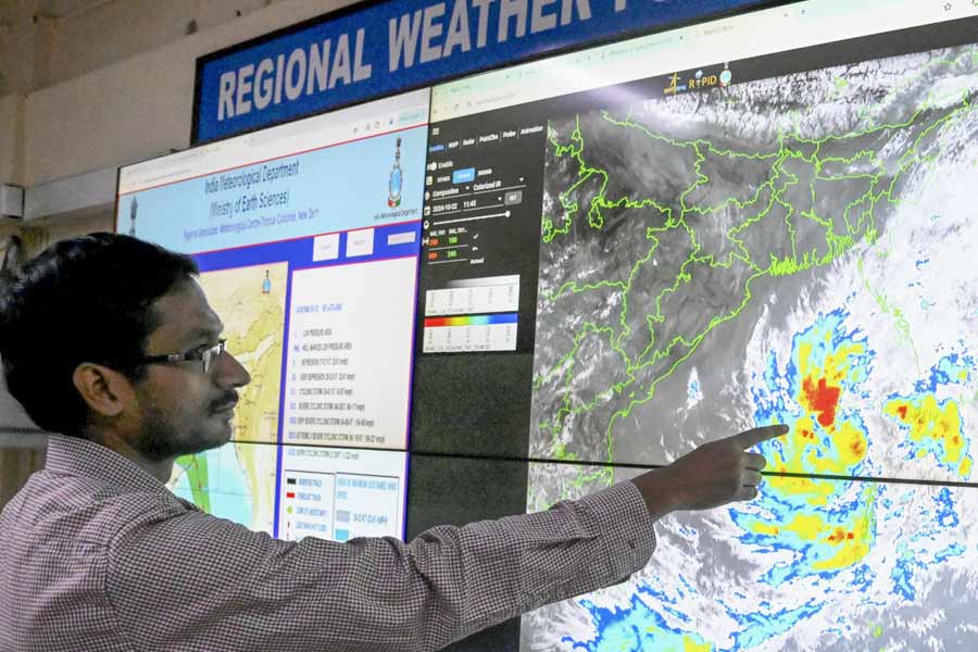
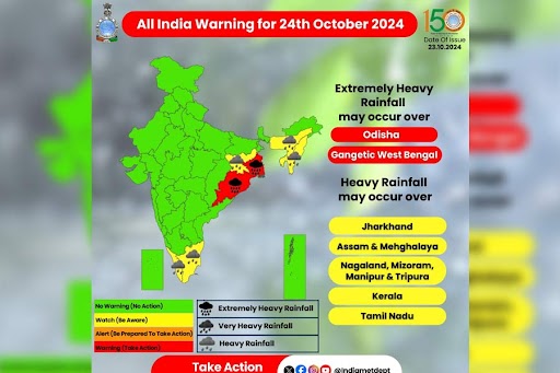
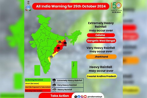
Indian Meteorological Department (IMD) has issued severe weather warnings for both Odisha and Gangetic West Bengal. The cyclone will make landfall near Dhamra Port in Odisha and will curve leftward within the state.
West Bengal may avoid the storm’s direct path, but districts such as East Medinipur and South 24 Parganas are bracing for significant impact, with Kolkata expected to experience heavy downpours.
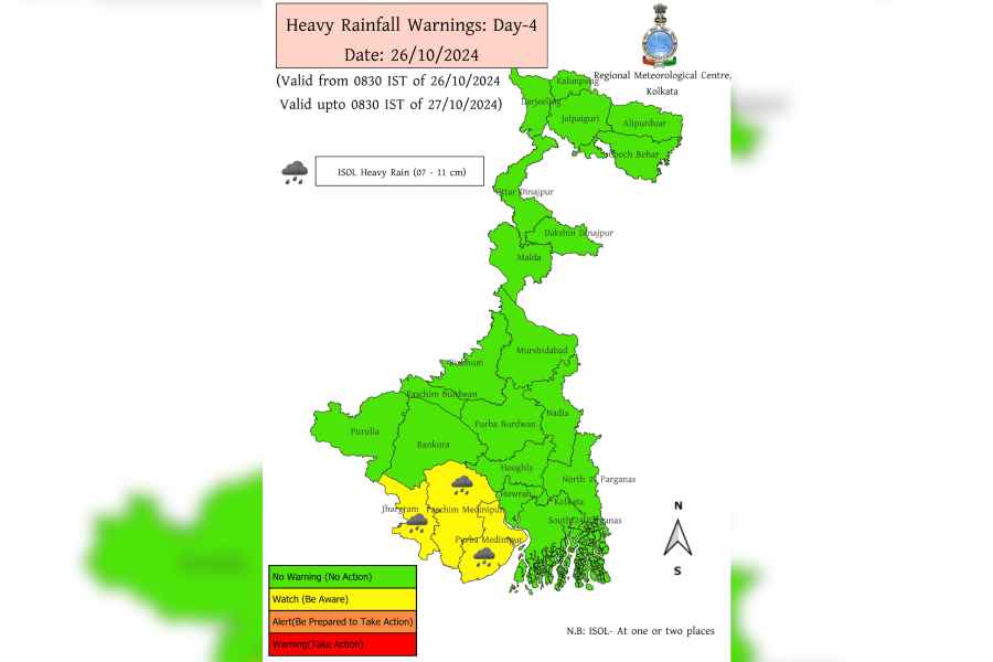
The IMD has also predicted heavy to very heavy rainfall in the districts of Kolkata, North and South 24 Parganas, Purba and Paschim Medinipur, Jhargram, Howrah, and Hooghly.
On October 24 and 25, there will be isolated extremely heavy rainfall, which poses a risk of flooding in low-lying areas.
In coastal districts, winds could reach speeds of 120 km/hour by the evening of October 24, making conditions hazardous for fishermen and others near the coast.
The IMD has advised fishermen to avoid venturing into the sea from October 23 to 25, warning of dangerous maritime conditions along the Odisha-West Bengal coastline.
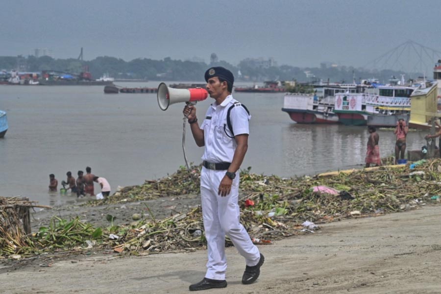
The Indian Coast Guard (ICG) is on high alert, having mobilized vessels and aircraft to respond to any emergencies at sea.
The National Disaster Response Force (NDRF) has deployed 13 teams across South Bengal to handle any contingencies related to the cyclone. Both organizations are prepared to respond to rescue and relief operations as required.
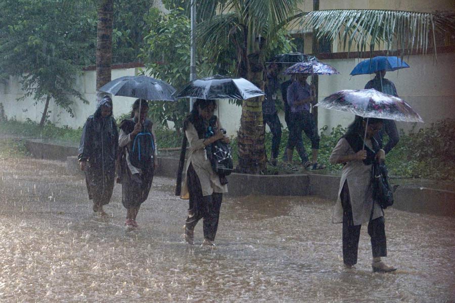
Authorities have urged the public to stay indoors during the cyclone’s peak and remain updated on official advisories. For those who must travel, authorities advise extreme caution, particularly because of the risk of flooding, fallen trees, and blocked roads. Power outages are expected in affected areas, according to authorities.