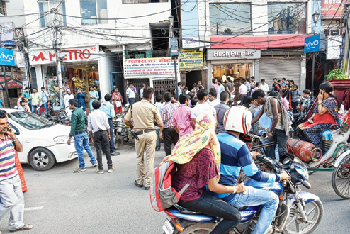
An earthquake of magnitude 6.7 on the Richter scale (as reported by India meteorological department) with the epicentre at central Myanmar was felt in Patna and most parts of Bihar on Wednesday around 4.04pm.
Many people across the state came out of their houses and stood on the roads and open grounds after feeling the tremors. The state emergency operation centre of the disaster management department, however, did not receive any report of loss of life or damage of property from anywhere in the state.
The primary shock was categorised as 'moderate' in nature and the Patna meteorological centre did not confirm any aftershocks. The depth of the tremor was 58km below the earth's surface. The depth of an earthquake indicates the distance under the earth's surface, where two tectonic plates collide, leading to release of energy that translates to ground shaking. Earthquakes having depth of 0-70km are categorised as shallow earthquakes and these cause damage at the earth surface.
Anil Kumar Sinha, vice-chairman at the Bihar State Disaster Management Authority (BSDMA) claimed that Wednesday evening's quake was too deep to have left any substantial impact in Bihar, which is located around 2,000km west from the epicentre (Chauk, north-central Myanmar). "More the depth of an earthquake, the lesser is its effect felt on the ground. The depth of this particular earthquake was 58km, which was quite much to have caused much damage at places like Bihar. However, it must have been felt across northeastern, eastern and southern states in India," said Sinha.
Many people in Patna felt the tremors. "I was studying when I felt a slight trembling for a few seconds. Though it seemed less in intensity I did feel it," said Pratyush Kumar, a resident of Ashiana Nagar. Sharing border with Nepal, Bihar lies in high seismic zones V, IV and III, where ground-shaking is felt considerably in case of earthquakes in Nepal. Districts such as Araria, Darbhanga, Madhubani, Purnea, Sitamarhi and Supaul along the Nepal border lie in Zone V - a very high risk zone for earthquake. Districts in central Bihar, including state capital Patna come in zone IV - a high risk zone. The southwestern districts of Aurangabad, Bhojpur, Buxar, Gaya, Jehanabad, Kaimur, Nawada and Rohtas lie in Zone III - an earthquake moderate zone.
The state at present has only one earthquake monitoring station, which is situated at Valmikinagar in West Champaran. However, sources claimed that the seismometer at that earthquake monitoring centre is not functional at present.
As a result, the Patna Meteorological Centre has been mostly found to be ill-equipped to furnish details of seismic activities in case of an earthquake, like the one recorded on Wednesday evening.
The Bihar State Disaster Management Authority is, however, presently working on a project envisaging installation of seismographs at 13 locations across the state under the "earthquake without frontiers" programme, which is funded by the UK government. The seismographs facilitate monitoring and assessment of the seismic activities underneath the ground, which in turn, helps the authorities in taking the required measure for earthquake preparedness.
Bihar State Disaster Management Authority vice-chairman Anil SInha claimed that the seismographs are already functional at four locations, including Engineering College at Motihari, SSB camp at Sonbarsa in Sitamarhi, SSB camp at Jainagar in Madhubani and SSB camp at Bathnaha at Forbesganj in Araria. The equipment are being installed by the Indian Institute of Science Education and Research (IISER), Calcutta.


